Subject: World
Period: 1796 (circa)
Publication: The American Universal Geography
Color: Black & White
Size:
9.9 x 7.2 inches
25.1 x 18.3 cm
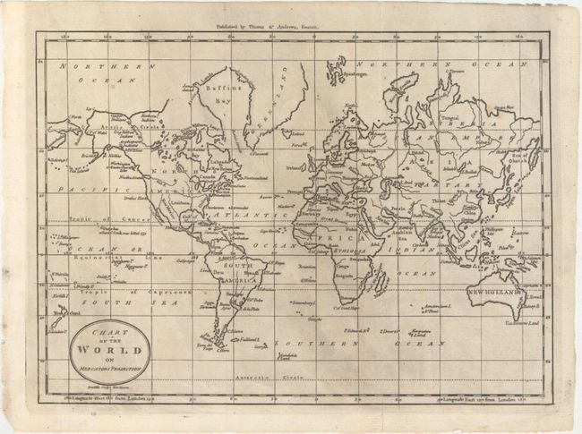
This map was Morse's second chart of the world. The United States appears to the east of the Mississippi with a few key cities identified, while the areas to the west of the Mississippi are labeled as Louisiana and New Mexico. A West R. runs from the center of North America to Nootka Sound. Numerous Indian tribes are located in present-day Alaska, and the Bering Strait is identified. Canada and Greenland's northern boundaries are left vague. A note in Hawaii marks the spot where Captain Cook was killed. New Guinea is depicted with an incomplete border, and Van Diemens Land is attached to the mainland of New Holland. Published by Thomas & Andrews, Boston and engraved by Amos Doolittle.
References: McCorkle (18th C. Geography) #304-17; Wheat & Brun #31.
Condition: A
Issued folding with printer's ink residue, a tiny hole in an unengraved area, and a couple of archivally repaired fold separations.