Catalog Archive
Auction 153, Lot 257

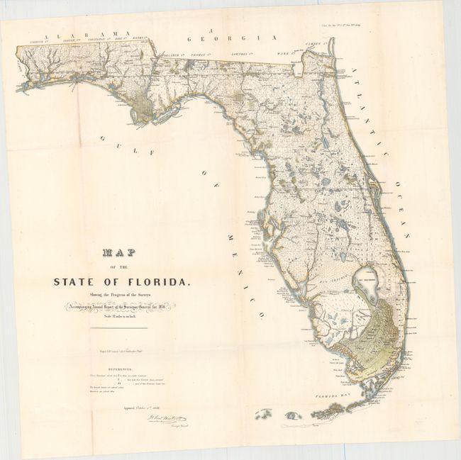
"Map of the State of Florida, Showing the Progress of the Surveys. Accompanying Annual Report of the Surveyor General for 1856", U.S. State Surveys

Subject: Florida

Period: 1856 (dated)

Publication: Sen. Ex. Doc. No. 5 3rd Sess. 34th Cong.

Color: Hand Color

Size:
24 x 24 inches
61 x 61 cm
Download High Resolution Image
(or just click on image to launch the Zoom viewer)

This is an early state survey map drawn on a scale of 12 miles to the inch that was published in the 1856 Annual Report of the Survey General. It details the topography, vegetation, towns, cities, forts, rivers, lakes, swamps and many early trails and roads. Most of the state has been surveyed. Area extends to show scores of keys, Dry Tortugas Island and Ft. Jefferson, and locates Ft. Lauderdale, Boca Rabones, Key Biscayne, and much, much more. It is signed in the plate by John Westcott, Surveyor General. Published by Wagner & McGuigan's Lithography.

References:

Condition: B+

Issued folding with light toning along the folds and a few tiny edge tears not affecting the map.

Estimate: $200 - $230

Sold for: $210

Closed on 5/20/2015

Archived