Subject: Colorado
Period: 1910 (dated)
Publication:
Color: Printed Color
Size:
21.3 x 18 inches
54.1 x 45.7 cm
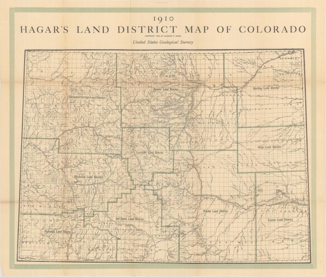
This very detailed map of the state by Clarence Hagar is divided into ten land districts and shows rivers, towns, cities and railroads. While the "United States Geological Survey" appears on this map, there is no evidence that it was published by the USGS. It is most likely that Hagar was giving the USGS credit for the base map.
Clarence Hagar arrived in Denver in 1863 at the age of 15. According to his obituary, he published the third daily newspaper in the city which was eventually sold to the Rocky Mountain News. He was also the first president of the Colorado Pioneer Printers. At the time this map was published, he served as Secretary to the State Board of Pardons.
References:
Condition: B+
Issued folding with a few short splits at fold intersections and light toning along the folds.