Subject: Mare Island, California
Period: 1857 (dated)
Publication:
Color: Hand Color
Size:
17.1 x 14.3 inches
43.4 x 36.3 cm
The Office of Coast Survey is the oldest U.S. scientific organization, dating from 1807 when Congress directed that a "survey of the coast" be carried out. By 1836, it was called the U.S. Coast Survey and in 1878, the name was changed to the U.S. Coast and Geodetic Survey. Today the Office of Coast Survey is a division of the National Oceanic and Atmospheric Administration NOAA.
The survey teams, composed of civilians as well as Army and Naval officers, charted the nation's waterways and produced a wide array of reports, survey charts, hydrographic studies of tides and currents, astronomical studies and observations, and coastal pilots. These charts are an important record of the changing nature of the nation's coastlines. In additional to coastal charts, the U.S. Coast and Geodetic Survey produced land sketches, Civil War battle maps, and the early aeronautical charts.
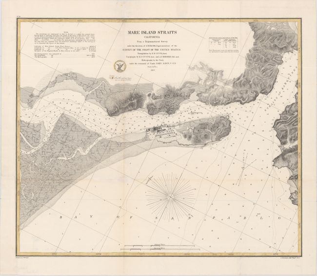
This intricately engraved chart focuses on Mare Island in San Pablo Bay. In the bay, soundings, bottom types, and a magnetic rose are shown. There is fine detail of the inland topography and waterways. Vallejo (which appears as Vallego) and the Navy Yard are shown in miniature plan form. Drawn by P. Witzel and lithographed by C.B. Graham.
References:
Condition: B+
Issued folding with a hint of toning along some the folds. Several short fold separations, a small hole at a fold intersection, and edge tears have been repaired with archival materials. A binding trim at bottom left has been replaced with old paper.