Subject: Southwestern United States
Period: 1873-74 (dated)
Publication:
Color: Hand Color
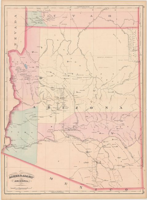
A. Asher & Adams' Arizona, dated 1874 (17.0 x 22.6"). This map shows an early Arizona with five very large counties that composed the territory of the time. The map displays major rivers, numerous mines, military and Indian reservations, and the progress of public surveys. It also depicts a few key roads and two proposed east-west rail lines across the territory. A small Navajo Reservation is noted in the northeast corner and Tucson is shown as the territorial capital.
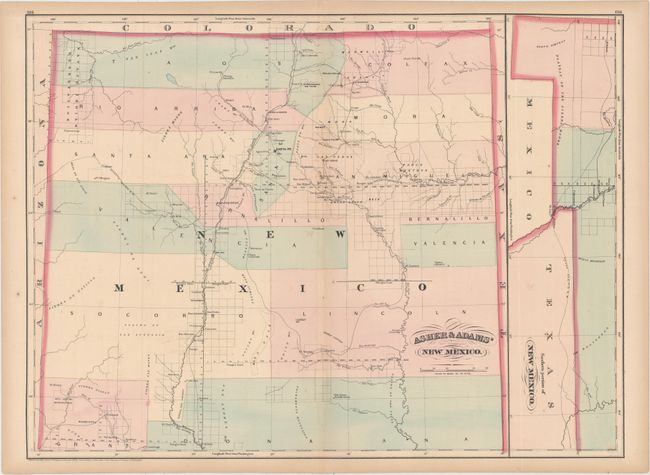
B. Asher & Adams' New Mexico, dated 1873 (22.5 x 16.6"). Another double-page map focused on New Mexico with the southern portion of the state shown in an inset at right. 13 counties are noted and Santa Fe is shown as the capital. The map displays major rivers, proposed railroads, Indian and military reservations, the progress of public surveys, and Maxwell Grant along the border with Colorado.
References:
Condition: B+
Original color with faint offsetting, a few spots of foxing, and light toning along sheet edges.