Subject: Western United States
Period: 1799 (published)
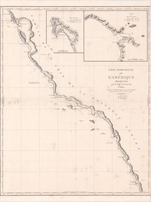
Publication: Vancouver's Voyages (French Edition)
Color: Black & White
Size:
24.2 x 30.2 inches
61.5 x 76.7 cm
This is the French edition of an important, large-scale chart featuring the coastal topography from Bodega Bay to the mission at St. Domingo on the Baja. The track of Vancouver's exploration in 1792-93 is shown complete with soundings. Spanish missions and forts are located along the coast. The map is one of the best early maps of the Channel Islands and provides excellent coastal topographical information. The large insets of the entrance to San Francisco Bay and the port of San Diego are among the earliest obtainable examples of maps focusing on these two bays. During the summers of 1792-94, George Vancouver and the crew of the British naval ships Discovery and Chatham mapped the western coast of North America from Baja California to Alaska. Vancouver's voyage was the last, and longest, of the great Pacific voyages of the late eighteenth century. Taking the art and technique of distant voyaging to a new level, Vancouver eliminated the possibility of a Northwest Passage, and his remarkably precise surveys completed the outline of the Pacific.
References: Phillips (A) #1219; cf. Wagner #856; cf. Streeter #3497-8.
Condition: B
A crisp impression on a sturdy sheet with light scattered foxing and short centerfold separations at left and right. The margins have been trimmed, with parts of the neatline missing at left and complete loss of neatline at right.