Subject: Wisconsin, Michigan, Great Lakes
Period: 1860-80 (circa)
Publication:
Color: Hand Color
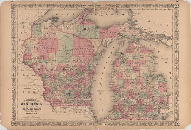
A. Johnson's Wisconsin and Michigan, by Johnson and Ward, dated 1864 (23.4 x 17.1"). This double-page map covers both Wisconsin and Michigan with county development shown in full hand color. The map is dense with towns and cities, railroads, and rivers, although there is considerably less settlement in the northern parts of the states. The county configuration is current to 1862, as evinced by the presence of Schoolcraft County in Michigan and the name change from Bad Axe to Vernon County in Wisconsin. Notes in lakes Superior, Michigan, and Huron state their elevation above sea level, average depth, and total area. Condition: There are separations along the centerfold, minor offsetting, and faint scattered foxing. In the blank margins there are a number of chips and edge tears, as well as toning. (B)
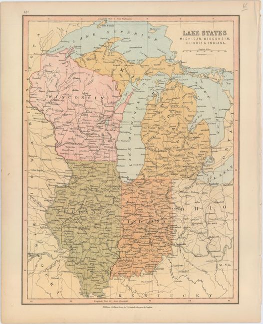
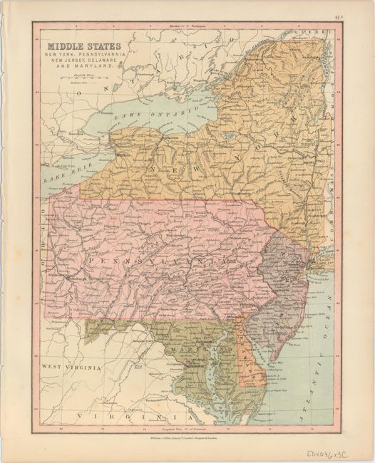
B. Lake States Michigan, Wisconsin, Illinois & Indiana [on verso] Middle States New York, Pennsylvania, New Jersey, Delaware and Maryland, by William Collins, Sons & Co., circa 1880 (8.9 x 11.9"). This striking map shows towns and cities (including Chicago, Detroit, Milwaukee, and Indianapolis), rivers, and the area's network of railroads. Parts of Minnesota, Ontario, Iowa, Missouri, Kentucky, Ohio, and West Virginia are also depicted. Condition: Clean and bright with light toning along the edges of the sheet. (A)
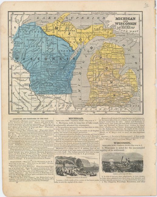
C. Michigan and Wisconsin, by Sidney E. Morse, circa 1860 (8.3 x 6.4"). This map, located on a page from a geography textbook, features county configurations that are up to date as of 1858-59. Beneath the map are vignettes illustrating an assembly of Indians at Mackinaw and a pair of Indians gathering wild rice. Additional vignettes appear on the verso depicting a prairie aflame, an Indian attack on traders in Santa Fe, and a scene of Indians fishing. On a full sheet of text measuring 9.4 x 12.0". Condition: There is light soiling outside the map image. (A)
References:
Condition:
See description above.