Subject: Illinois, Iowa, Missouri
Period: 1853-60 (circa)
Publication:
Color: Hand Color
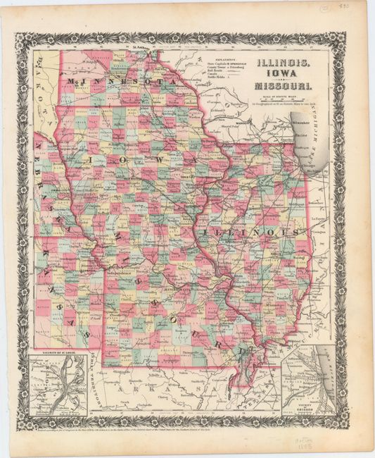
A. Illinois, Iowa and Missouri, by J.H. Colton & Co., from Colton's Illustrated Cabinet Atlas, dated 1858 (10.8 x 12.8"). This attractive county map shows the expanding railroad network in the region. Towns and cities, railroads, canals, and battlefields are identified, and the map includes insets of the vicinities of St. Louis and Chicago. The county configuration is up to date to 1859. Parts of Dakota, Nebraska, Kansas, Indian Territory, Arkansas, Tennessee, Kentucky, Indiana, and Wisconsin appear as well. The map is surrounded by a floral border. Condition: There is a touch of soiling by the title and marginal toning, else fine.
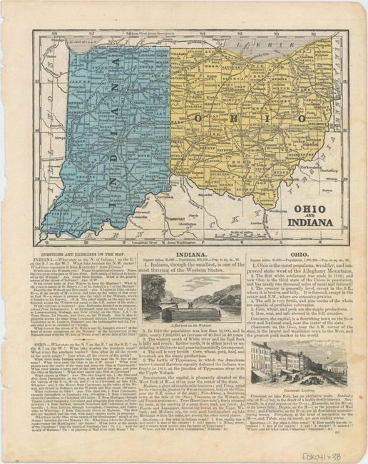
B. Iowa Illinois and Missouri [on verso] Ohio and Indiana, by Sidney E. Morse, circa 1853 (8.3 x 8.5"). This sheet comes from a geography book and contains a map of Iowa, Illinois, and Missouri on recto and Ohio and Indiana on verso. County configuration suggests a publication date of around 1853. Two vignettes, A flat-boat on the Wabash and Cincinnati Landing, appear on verso. On full sheet of text measuring 9.5 x 12.0". Condition: Minor soiling and faint show-through of text on verso. There are some small chips along the sheet's edges.
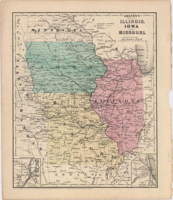
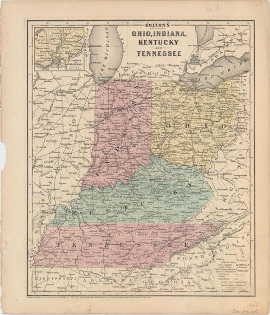
C. Colton's Illinois, Iowa and Missouri [on verso] Colton's Ohio, Indiana, Kentucky and Tennessee, by J.H. Colton, dated 1860 (9.9 x 12.1"). This striking map shows the counties, towns and cities, railroads, canals, and battle fields of Iowa, Missouri, Illinois, and their immediate surroundings. There are insets at bottom focusing on St. Louis and Chicago. The county configuration is current as of 1860, as evidenced by the presence of O'Brien County in Iowa. The verso features a map of Ohio, Indiana, Kentucky, and Tennessee with an inset of Cincinnati. Condition: A couple faint spots within the image and some short splits and a chip in the right blank margin.
References:
Condition: A
See description above.