Subject: Wisconsin, Minnesota
Period: 1848 (circa)
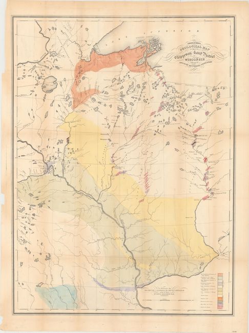
Publication: Report of a Geological Reconnaissance of the Chippewa land district…
Color: Hand Color
Size:
23 x 34 inches
58.4 x 86.4 cm
An early geological survey of the area from Prairie du Chien (here also Fort Crawford and Kipy Saging) and north along the Mississippi River to the Minneapolis area and beyond to Duluth. The eastern range includes the rapids along the northern reaches of the Wisconsin River. A legend in the lower right explains the use of color to indicate the twelve different geological types. This scarce map was prepared to illustrate David D. Owen's report on his geological reconnaissance. Owen and his staff are reported to have worked 12-15 hours every day during the summer and winter of 1847 for this notable survey.
References: Marcou & Marcou #451.
Condition: B
Issued folding, with original hand coloring, light toning along the folds, and a few faint tape stains. Now pressed and backed with archival tissue to repair some short fold separations and minor tears.