Subject: Central & Southern United States
Period: 1884 (dated)
Publication: 5th Annual Report Bureau of Ethnology
Color: Printed Color
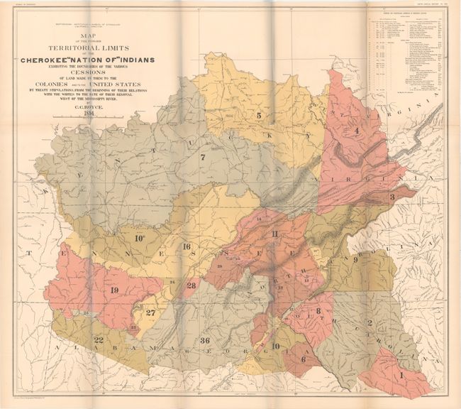
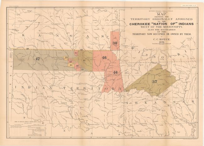
A matched pair of important Cherokee Nation maps. The first title continues, "...Made by Them to the Colonies and to the United States by Treaty Stipulations, from the Beginning of Their Relations with the Whites to the Date of Their Removal West of the Mississippi River." It shows the former territorial limits of the Cherokee Nation between the Ohio and Tennessee rivers and the Appalachian Mountains. Key lists 36 cessions from 1721 to 1835 which are numbered and colored on the map (31 x 28"). The second map's title continues "Also the Boundaries of the Territories Now Occupied Or Owned by Them" and lists cessions 37-47, Treaties of May 6, 1828 and July 19, 1866. This map also includes a small section of Public Lands, Kansas, Missouri and Arkansas. Shows many villages, forts and Indian Agencies (30 x 20.5"). A terrific pair of large maps portraying an important period in U.S. and Native American history and relations.
References:
Condition:
An attractive pair with strong color and wide margins. The maps have light toning and several short splits at fold intersections. The larger map (former territorial limits) has several separations along the right fold partially closed on verso with archival tape (B) while the smaller map has some faint color offsetting (B+). Please note that there is a bluish hue in the images caused by our scanner that is not present on the physical map.