Subject: Colonial Southeast United States
Period: 1780 (dated)
Publication: Political Magazine
Color: Hand Color
Size:
14.8 x 10.8 inches
37.6 x 27.4 cm
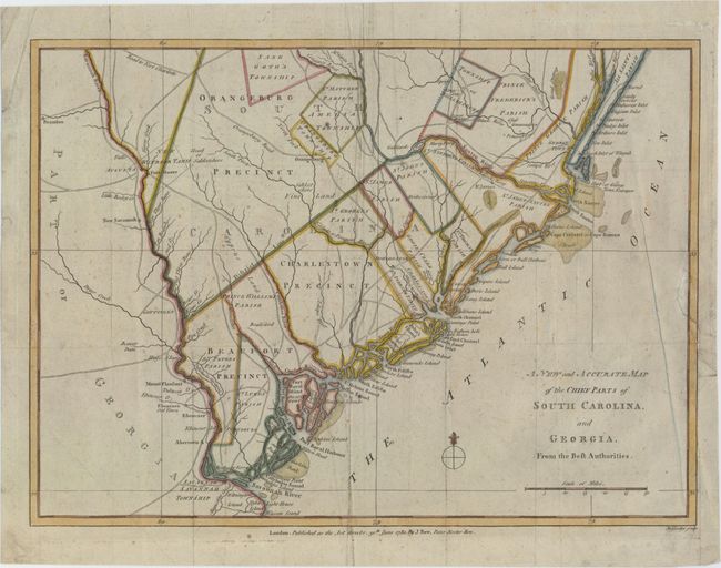
Scarce Revolutionary War map of the region in South Carolina and Georgia from about the Savannah River to the Wackamaw River. The map was created to depict important battle sites and British victories during the Southern Theater of the war, including the capture of Savannah, Georgia in December 1778 and Charleston, South Carolina in May 1780. The map is filled with detailed information of the roads, forts, towns, townships, precincts and parishes. Published by John Bew.
References: Jolly #POL-7.
Condition: B+
A nice impression with attractive color on watermarked paper. There is light scattered foxing and soiling. Issued folding with a binding trim that has been replaced with old paper and an adjacent binding tear that enters 2" into map and has been repaired with archival material.