Subject: Mid-Atlantic United States
Period: 1932 (dated)
Publication:
Color: Printed Color
Size:
33.3 x 20.2 inches
84.6 x 51.3 cm
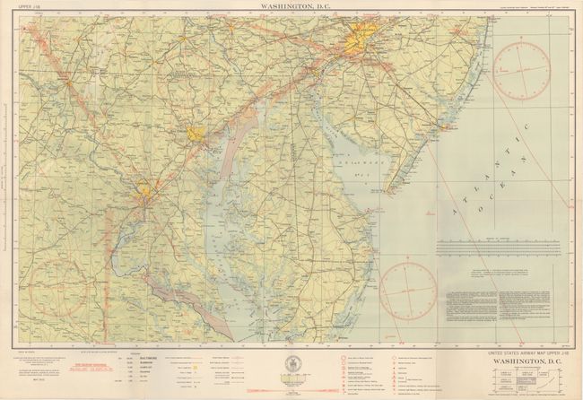
In 1921, the United States Army Air Corps initiated a compressive evaluation of aeronautical charts in an effort to develop a standardized map for aerial navigation. Based upon this study, the Air Corps issued 63 air navigation maps covering most of the military routes in the United States. Prior to 1926, these maps were jointly compiled by the Geodetic Survey and U. S. Army Engineer Reproduction Plant. By 1926, the preparation of air maps were fully compiled by the U.S. Coast and Geodetic Survey (under the Commerce Department) with the passage of the Air Commerce Act. Maps from this point on were intended to merge the growing commercial airways system with the military network.
This map covers the area from Fredericksburg, VA. to Philadelphia (including the cities of Washington, Baltimore and Wilmington) and shows elevation and contours, cities and towns, rivers, roads and railroads. Airfield classifications are shown with different symbols including seaplane landings. True north and magnetic north are depicted. On a scale of 8 miles per inch. Price 40 cents at bottom left.
References:
Condition: A+
A clean, bright example. Issued folding with one tiny split at a fold intersection.