Subject: Colonial Mid-Atlantic United States, Revolutionary War
Period: 1776 (published)
Publication: Gentleman's Magazine
Color: Black & White
Size:
8.5 x 7 inches
21.6 x 17.8 cm
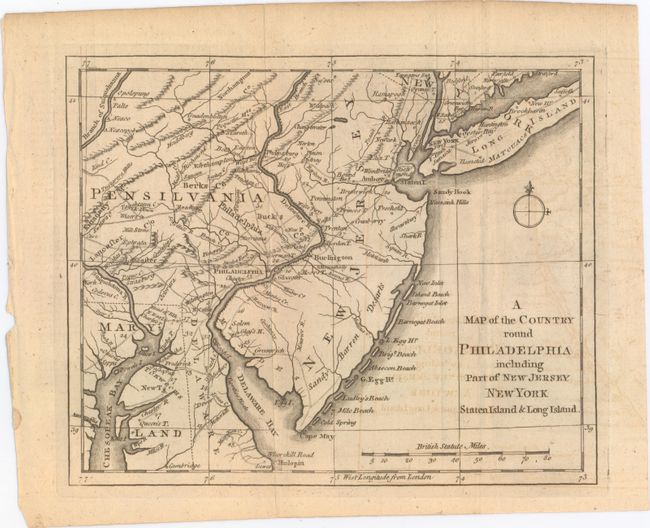
This Revolutionary War period map encompasses the area of Eastern Pennsylvania through Long Island and south to include Chesapeake Bay. The map was issued to illustrate the British Army's objective of defeating Gen. Washington at Long Island and then to march to Philadelphia and put a quick end to the conflict. It is centered on Philadelphia, includes most of New Jersey, Delaware, Long Island, southeastern Pennsylvania, northern Chesapeake Bay and the greater New York City area. The southern New Jersey coast is labeled Sandy Barren Desarts. The map is filled with interesting features including Indian villages, towns and cities, ferries, and roads (including the distances between towns). Adorned with a simple compass rose.
References: Jolly #GENT-247; Phillips (M) p.699; Sellers and Van Ee #1041.
Condition: B+
Issued folding with light offsetting and a minor misfold.