Catalog Archive
Auction 153, Lot 159

"A Map of Connecticut and Rhode Island, with Long Island Sound, &c.", Anon.

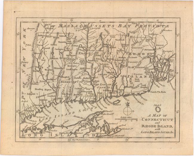
Subject: Colonial New England - United States, Revolutionary War

Period: 1776 (circa)

Publication: Gentleman's Magazine

Color: Black & White

Size:
9 x 6.9 inches
22.9 x 17.5 cm
Download High Resolution Image
(or just click on image to launch the Zoom viewer)

This Revolutionary War period map has good detail of early settlements including roads, villages and ports, and locates New London, Groton, Stanford, Norwalk, New Haven, and Seabrook. The counties of Fairfield, New Haven and New London are noted in Connecticut. There is a copper mine near Simsbury, CT. Includes a portion of eastern Long Island from Hog Neck to Montuck Point, noting villages and roads. This is the last of a series of four maps issued in the Gentleman’s Magazine during 1776 to illustrate the growing unrest in the colonies.

References: Jolly #GENT-249; Sellers & Van Ee #819; Thompson #25.

Condition: B+

Issued folding with faint offsetting.

Estimate: $180 - $220

Sold for: $130

Closed on 5/20/2015

Archived