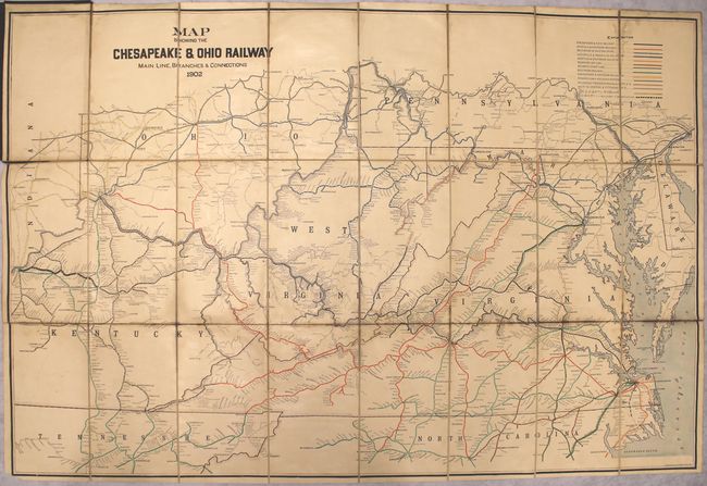
Subject: Eastern United States, Railroads
Period: 1902 (dated)
Publication:
Color: Printed Color
Size:
42.4 x 28.2 inches
107.7 x 71.6 cm
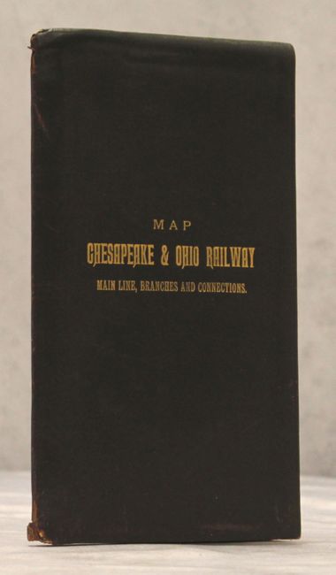
This large format map shows the railroad network from Pennsylvania and Ohio south to Tennessee and North Carolina. Thirteen different railroads are represented on the map along with the Chesapeake & Ohio lines under construction in West Virginia. The verso contains several florid manuscript signatures of E.P. Goodwin who was an executive with the C&O Railroad. No copies located in OCLC or elsewhere, indicating that the map was most likely limited to internal use by the railroad. Dissected into 24 panels and backed with linen. Folds into gilt-stamped full leather covers.
References:
Condition: B
Issued folding with light toning, minor offsetting, and a few small damp stains along the top neatline and lower fold. The linen has separated in a few places but does not impact the map image. Covers are very good with small chips of the spine at top and bottom and a few minor abrasions on the covers.