Subject: Eastern United States
Period: 1838-41 (circa)
Publication:
Color: Black & White
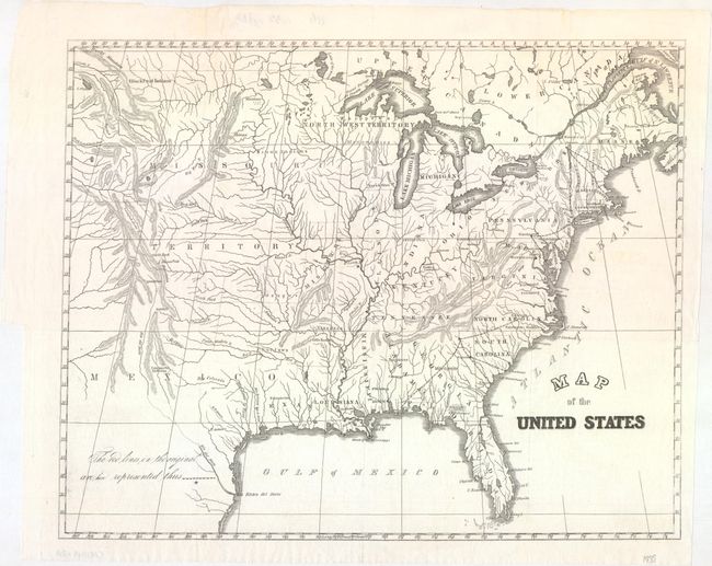
A. Map of the United States, by U.S. Government, circa 1838 (14.6 x 11.7"). This unusual little map features a large Missouri and Northwest Territory, and depicts Kentucky as part of Virginia. The names of Louisiana and the Republic of Texas are shown on the Gulf Coast, with a hint of a border beginning to be shown for Louisiana. A number of native tribes are located, and early railroads are delineated. A note at the left refers to dotted lines that replace red lines used in the original map. Condition: A crisp impression issued folding with a couple archivally repaired fold separations at top.
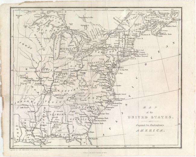
B. Map of the United States. Engraved for Buckingham's America, by Fisher, Son & Co., circa 1841 (9.4 x 7.8"). This uncommon small map of the eastern United States extends as far west as the border between the Republic of Texas and Louisiana. There is some topographical detail and many place names are identified. Iowa Territory appears as Ioway and borders Wisconsin Territory. Engraved by "the Omnigraph." Condition: Issued folding with minor offsetting from an opposing page of text. Clean and bright with an edge tear in the bottom blank margin.
References:
Condition: A
See description above.