Subject: United States
Period: 1855 (circa)
Publication: The Imperial Atlas
Color: Hand Color
Size:
19.7 x 13.6 inches
50 x 34.5 cm
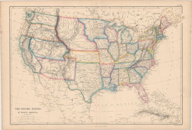
Very precisely engraved map with remarkable territorial boundaries. A large Texas includes today's Oklahoma. Oregon and Washington extend to the Continental Divide. Utah includes present-day Nevada and much of Colorado. New Mexico Territory includes Arizona, the Las Vegas area and a portion of southern Colorado. A huge Nebraska Territory fills the region between the Rocky Mountains and an enlarged Minnesota. Kansas extends to the eastern boundary of Utah. This interesting map is filled with place names, forts, watershed and topographical information. Drawn by J.W. Lowry and published in Glasgow, Scotland.
References:
Condition: A
Attractive original color with just a few faint spots, mostly in the blank margins.