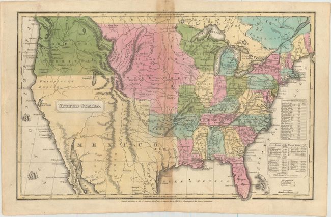
Subject: United States
Period: 1830-32 (dated)
Publication:
Color: Hand Color
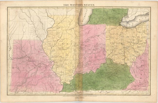
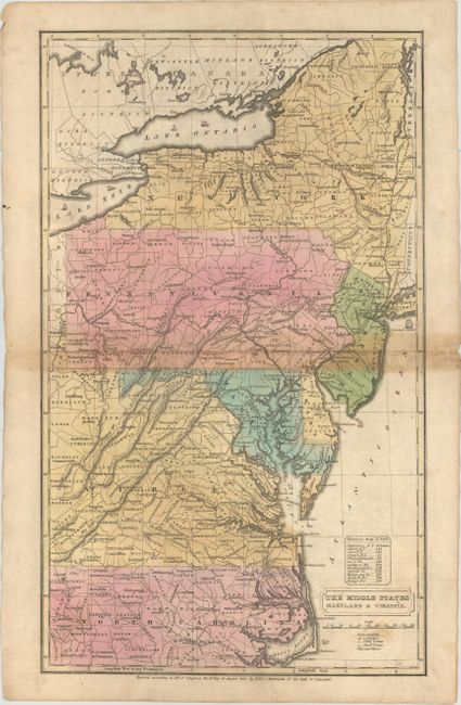
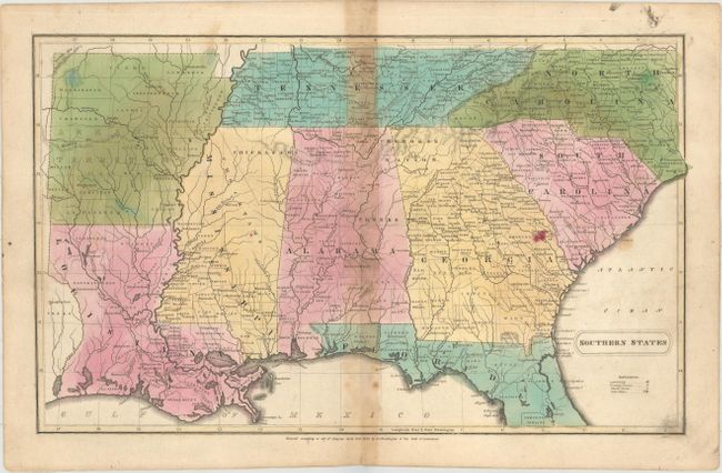
A nice set of double-page maps showing the extent of the evolving country. The United States map shows a large Arkansas Territory including present-day Oklahoma, Missouri Territory bounded by the Mississippi River and the Continental Divide, and Oregon Territory extending well north into present-day British Columbia. The regional maps depict county development with numerous towns located and named. The list of maps include:
A. United States, dated 1830 (15.9 x 10.2").
B. The Western States, dated 1832 (15.9 x 9.9").
C. The Middle States Maryland & Virginia, dated 1830 (9.6 x 16.2").
D. Southern States, dated 1832 (15.9 x 9.8").
References:
Condition: B
Original color with centerfold toning, a few spots of foxing, and minor soiling. Several sheets have short centerfold separations that have been closed on verso with archival materials.