Subject: Vancouver Island, Canada
Period: 1895 (dated)
Publication:
Color: Black & White
Size:
36.6 x 26.9 inches
93 x 68.3 cm
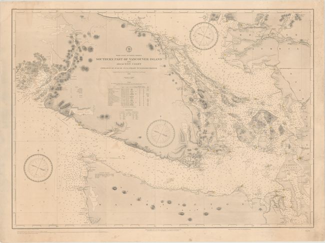
This large-scale chart depicts the southern tip of Vancouver Island surrounded by the Strait of Georgia and the Strait of Juan de Fuca. The map extends to include the northwest corner Washington State and as far north as the city of Vancouver. Numerous towns, points, ports, and capes are located along the coasts, including Victoria, the capital of British Columbia. The waters are filled with soundings, anchorages, shoals, rocks, buoys, and navigational information. Two tables below the title list the lighthouses in the region and the abbreviations for the ground materials found below the surface of the water. The chart was "compiled from the latest British and United States Coast Surveys" in 1886, with extensive corrections in 1892, 1893 and 1895. Drawn by G. R Bechler and engraved by J. Enthoffer and J. L. Hazzard. Backed in linen.
References:
Condition: B+
A nice impression with original color (red and yellow) on lighthouses. There is very light toning, minor mildew spots, and a few faint damp stains. Backed in linen to repair a tear that enters 7" into image at right.