Subject: Eastern Canada, Railroads
Period: 1847-49 (dated)
Publication:
Color: Hand Color
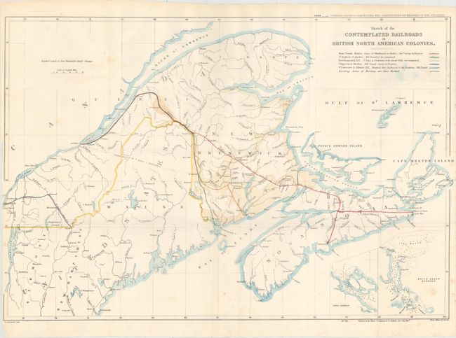
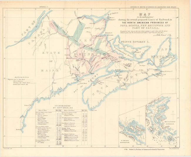
This attractive pair of early railroad maps depicts existing and proposed railroads in Eastern Canada. While the first railroad in Canada was completed in 1836, railroad construction didn't accelerate until the late 1840s and 1850s.
A. Sketch of the Contemplated Railroads in British North American Colonies, dated 1847 (28.9 x 19.3"). Map covers the region from Montreal and Quebec east to Nova Scotia highlighting five different proposed lines in different hand color along with existing lines in black. Identifies land grants in orange. Published in the Correspondence Respecting the Construction of Railways in the Colonies. Condition: Issued folding with light scattered foxing and a binding trim at lower left. (B+)
B. Map (for Mercator's Projection) Shewing the Several Proposed Lines of Railroad, in the North American Provinces of Nova Scotia, New Brunswick and Part of Canada, dated 1849 (19.8 x 15.6"). Issued two years after the previous map, this smaller edition also depicts proposed railroads in New Brunswick and Nova Scotia and adds direct distances between various locations. Land grants are highlighted in pink. Published in the Appendix to Minutes of Evidence on Colonization from Ireland. Condition: Issued folding on a clean, bright sheet. (A)
References: Phillips (Maps) p. 197.
Condition:
See description above.