Catalog Archive
Auction 153, Lot 102

"A New Map of New Found Land, New Scotland the Isles of Breton, Anticoste, St. Iohns &c. Together with the Fishing Bancks", Moll, Herman

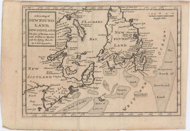
Subject: Eastern Canada

Period: 1741 (published)

Publication: The British Empire in America

Color: Black & White

Size:
10.2 x 7.1 inches
25.9 x 18 cm
Download High Resolution Image
(or just click on image to launch the Zoom viewer)

This is the second state of Moll's map of the Gulf of St. Lawrence, which was first published in The British Empire in America in 1708. This map appears to be based on Thornton's two maps of 1676 and 1689, in which Acadia has a triangular shape and Newfoundland has a truncated top. The map shows particularly good detail of the fishing banks and coastlines.

References: Kershaw #564.

Condition: B+

Issued folding on watermarked paper with minor soiling and several faint damp stains.

Estimate: $160 - $190

Sold for: $120

Closed on 5/20/2015

Archived