Subject: World & Continents
Period: 1595 (published)
Publication: Epitome Theatri Orteliani
Color: Black & White
Size:
4.3 x 3.1 inches
10.9 x 7.9 cm
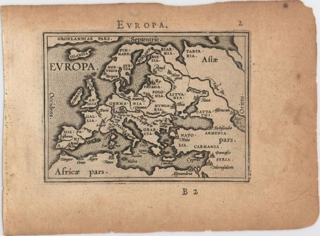
This is a fine matched set of miniature world and continents from Philippe Galle's 1595 edition of Ortelius' Theatrum. The first pocket version of the Theatrum was published by Galle in 1577, and the publication continued until 1598. From 1583 he gradually introduced a new set of maps, both adding to and replacing the originals. In this set we have the map of America from the original plate with small decorative borders, while the remaining plates are from the updated second series of plates with plain double-line borders. Each map is a faithful miniaturization of the folio map with some place names and geographic features omitted due to size. They are adorned with ships, sea monsters, and strapwork cartouches. Latin text on verso.
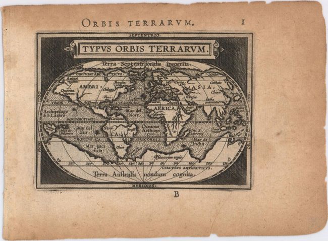
A. Typus Orbis Terrarum. This map was reduced from Ortelius' folio map of 1587. While North America is still a bit too broad, South America has a more correct form. The Northwest Passage, taken from Mercator, is still prominent and there are large landmasses at both poles. Reference: Shirley #161.
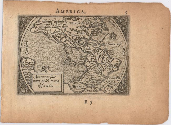
B. Americae sive Novi Orbis Nova Descriptio. This is a reduced version of Ortelius' 1570 folio map of the Americas. The characteristic bulges in the western coastlines of both continents and the huge southern continent are instantly recognizable. Reference: Burden #48.
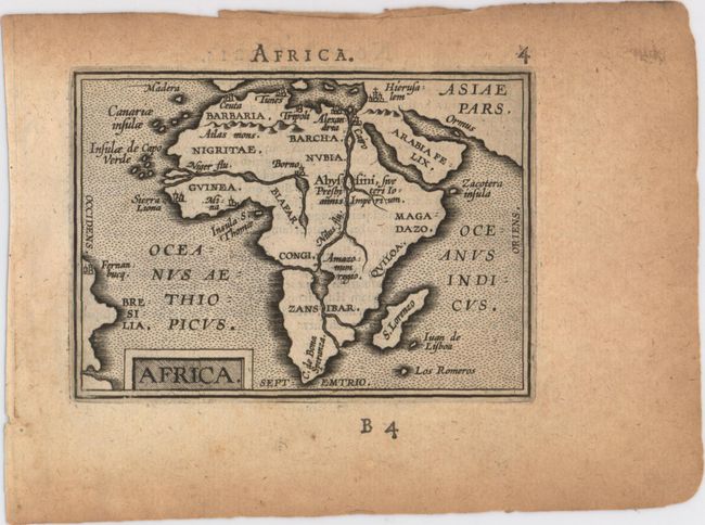
C. Africa. This is a simplified version of the first plate of Africa by Galle, with less geographic detail. Although the river systems still reflect Ortelius, the second source of the Nile River, Lake Zaflan, is removed. Only two towns are identified south of the Sahara Desert: Sierra Liona and Mina. Reference: Betz #28.
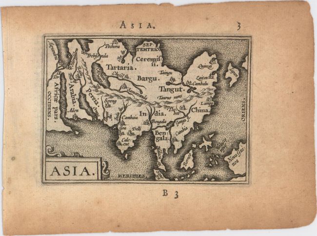
D. Asia. This map is based on Ortelius' great map of Asia that was the standard map of Asia for more than forty years. Japan is in a 'kite' form taken from Jesuit sources and the islands of the East Indies are not well placed, due to the secrecy of voyages to the region.
E. Europa. This simple map of Europe focuses on the major rivers, mountain ranges, and cities in Europe. Greenland stretches across the top of the map.
References: King (2nd ed.) pp. 60-61 & 64-65; Van der Krogt (Vol. III) #332:12.
Condition: B+
Fine, crisp impressions on watermarked paper with light toning primarily confined to blank margins. There area few tiny tears and chips along edges of sheets, far from images.