Subject: North America
Period: 1716 (circa)
Publication:
Color: Black & White
Size:
9.8 x 6.9 inches
24.9 x 17.5 cm
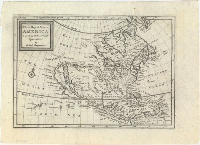
Attractive small map of North America that extends to include the West Indies and northern South America. The island of California dominates the west coast with the Straits of Anian, Mozeemlek Country, and Parts Unknown shown above the island. The British Colonies are confined to the eastern seaboard and Florida occupies all of the present southern United States. Lake Superior is simply named Upper Lake. Lahontan's mythical Longue River stretches between two lakes in the west, with a notation of "Many villages on the islands" in the most western lake. A decorative compass rose fills the Great South Sea.
References: cf. McLaughlin #225.
Condition: A
Issued folding, now flat, with a short printer's crease at top and a tiny fold separation in the top blank margin that has been archivally repaired.