Subject: Exploration and Surveys
Period: 1856 (published)
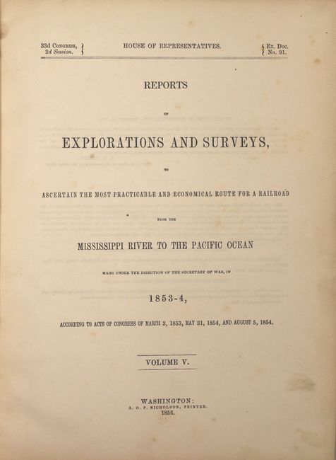
Publication: HR Ex. Doc. No. 91, 33d Cong., 2d Sess.
Color: Hand Color
Size:
9 x 11.5 inches
22.9 x 29.2 cm
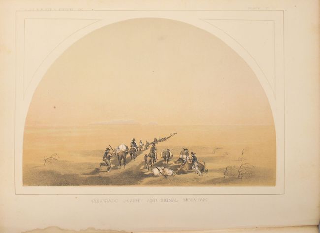
During the 1850s, the U.S. government sponsored an extensive series of expeditions designed to gather information on the vast new territories that had been acquired in western North America. The discovery of gold in California further stimulated westward traffic and heightened the need for a faster and more convenient way to bring the far-flung parts of the country together. In 1853 Congress commissioned the Army's Topographic Bureau to conduct a series of surveys to find a suitable route for a transcontinental railroad. There were six major expeditions; five of them covered the area between the Great Plains and west coast, and the sixth explored the coastal states of California and Oregon. All of these expeditions were accompanied by naturalists and artists to document the landscape, flora and fauna along the route.
The reports, maps and lithographs were published in the 13 volume report "Explorations and Surveys to ascertain the most practicable and economical route for a Railroad from the Mississippi river to the Pacific Ocean."
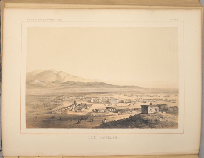
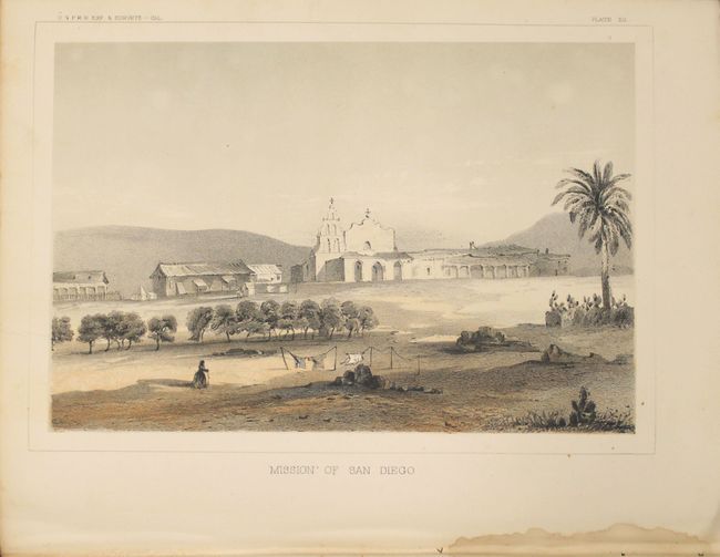
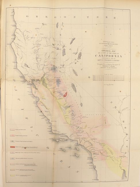
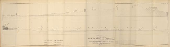
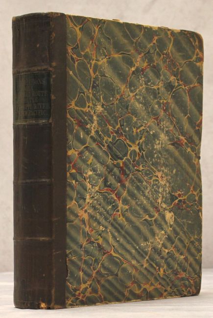
This is one of the most sought after Pacific Railroad reports because of its exceptional illustrations of topographic views by Charles Koppel and W. P. Blake (including Koppel's famous first published view of Los Angeles, and other early views of Benicia, San Fernando Mission, San Diego Mission, etc.), Blake's large color geological map of southern California, and wealth of information concerning early California life, gold rush areas, and geographical observations recorded along the route. This report describes Williamson's route from Benicia to San Diego examining mountain passes through the Sierra as the party headed southward. Volume V is one of the most richly illustrated volumes in the series containing numerous text illustrations , many color/tinted lithographs and colored geological maps and profiles. Blake's large folding map Geological Map of a Part of the State of California Explored in 1853 by Lieut. R. S. Williamson (18 x 24.5") shows the entire state with geological coloring extending from the gold mines near Sacramento on the north, to the Mexican line on the south, and from the Sierras on the east to the Pacific Ocean. Many of the important gold mining areas are shown. Lake Tahoe is shown as Lake Bonpland. Additional single page colored geological maps for the vicinity of San Francisco, Tejon Pass and Canada de Las Uvas, and Country between San Diego and Colorado River are also present. These are among the first colored geological maps produced for the state. Original leather spine over marbled boards.
References:
Condition: B+
The large folding map of California has a 3" binding tear closed on recto with archival tape, while the other plates and text are very good to near fine with some occasional foxing. Covers are lightly worn and the spine has a few cracks.