Subject: Exploration and Surveys
Period: 1779 (published)
Publication:
Color: Black & White
Size:
5.4 x 8.2 inches
13.7 x 20.8 cm
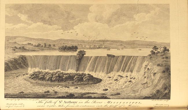
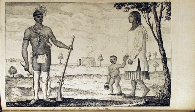
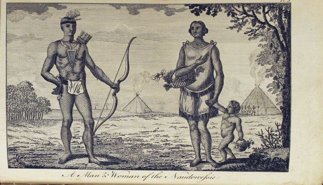
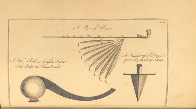
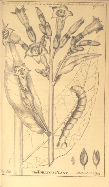
This fascinating book is Jonathan Carver's travelogue of his expedition to find a western water route to the Pacific Ocean. Born in Massachusetts in 1710, Carver enlisted in the Massachusetts colonial militia at the beginning of the French and Indian War, during which he learned surveying and mapping techniques. At the conclusion of the war, Carver quit the military with the hopes of exploring the new territories acquired by the British. In 1766, Carver was appointed by Robert Rogers to lead an expedition via lakes and rivers to the Pacific. Beginning at Fort Michilimackinac on present-day Mackinac Island, Carver traveled through Wisconsin, Minnesota, and Iowa over the next several years. Although he returned back to Fort Michilimackinac without completing his mission, Carver's expedition was notable for several discoveries. Carver traveled further west than any English-speaking explorer previously had, or would, until after the Revolutionary War. He is also credited as the first to note a large mountain range extending north-south to the west of the Mississippi River. And although he did not coin the term, Carver was the first to use the term "Oregon" in print, and his book served to popularize the term. Carver's book was quite successful, and was published in over thirty editions. This edition includes two maps and five plates depicting St. Anthony Falls, Native Americans and their tools, and a tobacco plant. The two maps are:
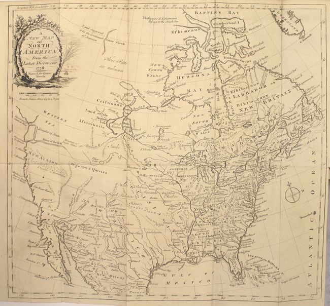
A New Map of North America. This uncommon map shows the route that Carver and his party were seeking with a boldly depicted River of the West connected by a dotted line to Pikes Lake, which is connected to the Mantons River (upper Missouri River). The Western Sea is noted in the Pacific Northwest, but is not delineated. At top Carver also hints at a Northwest Passage, with the note "the Suppos'd Eskimeaux Passage to the South Sea." The map features a delicately engraved title cartouche with a tree overlooking a river with a sailing ship.
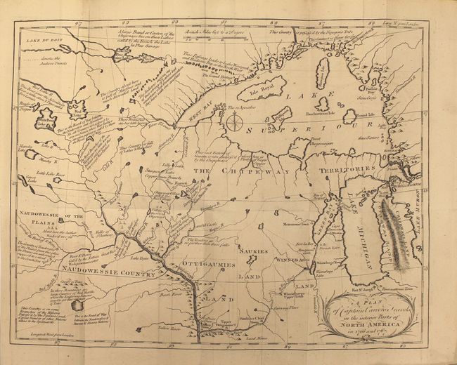
A Plan of Captain Carvers Travels in the interior Parts of North America in 1766 and 1767. A terrific early map of the region of today's Wisconsin and Minnesota. Filled with details and notations such as "Traders go no farther than these falls" and "seldom travel this way except War Parties" and many more. The route of Carver's travels are clearly shown along the Mississippi, Fox, Minnesota and St. Pierre rivers. The map extends from Michigan, here labeled Chipeways and Ottowas Land, to above Lake Superior and west to beyond the Minnesota River.
Second edition. Two folding maps, 5 plates, title page, dedication, address, table of contents, introduction, text, dictionary of Chippewah language, appendix. Octavo, original full leather with gilt embossing and leather title labels on spine. A.E.G.
References: Wheat (TMW) #175; Howes #C-215.
Condition: B+
Both maps are in excellent condition with minor offsetting and the text is clean and bright with an occasional light spot of foxing. <i>A New Map of North America</i> has a professionally repaired binding tear that enters about 1" into map and a fold separation that enters 1/4" into map at right. The title page has a mildew stain. The contents are tight, but the moderately worn covers and backstrip are detached.