Subject: Atlases, Kansas
Period: 1887 (published)
Publication:
Color: Hand Color
Size:
15.5 x 18 inches
39.4 x 45.7 cm
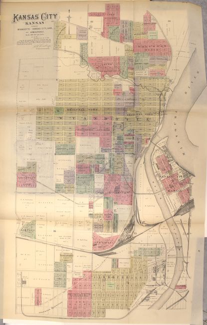
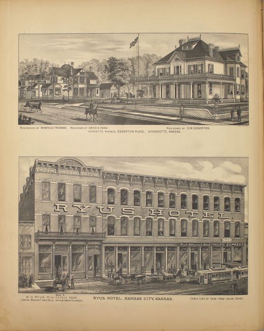
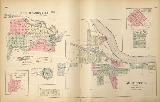
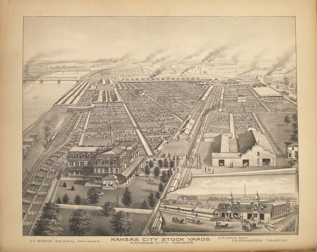
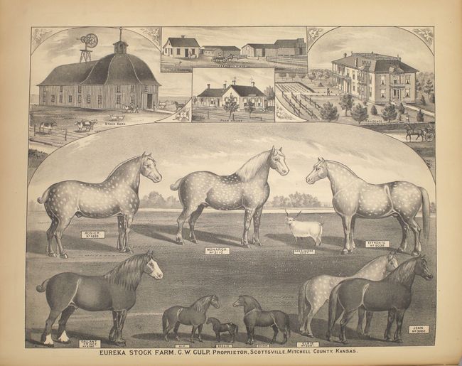
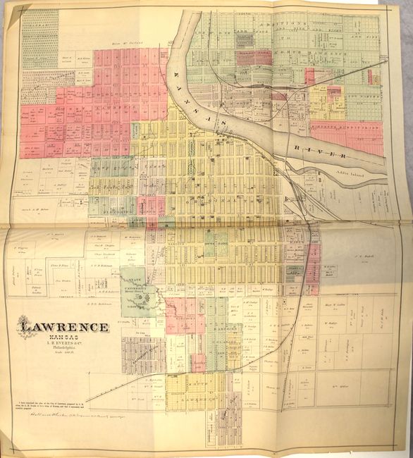
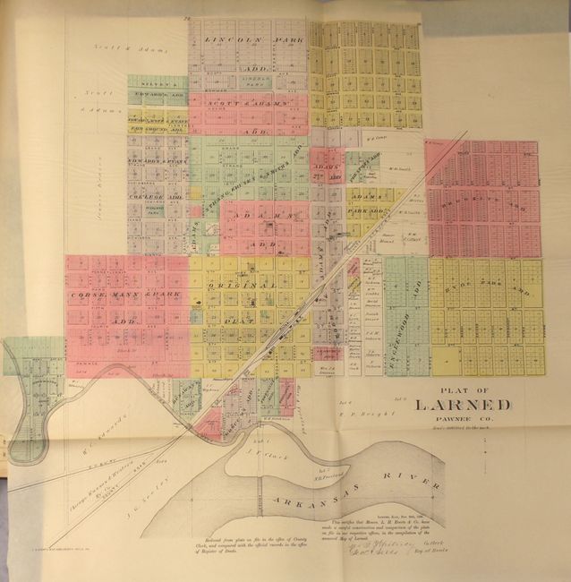
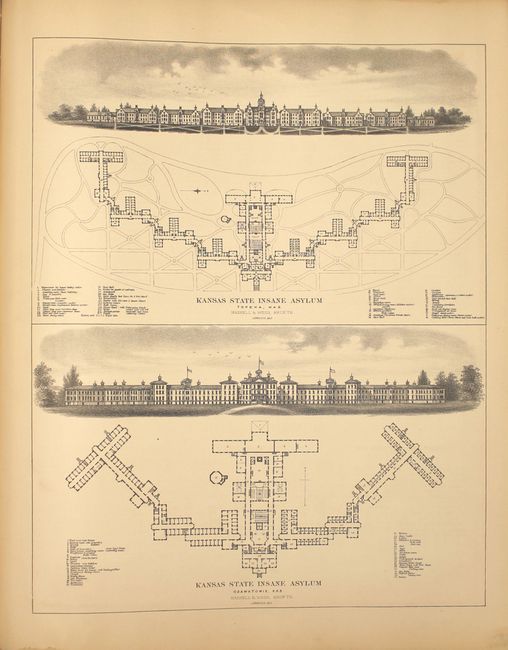
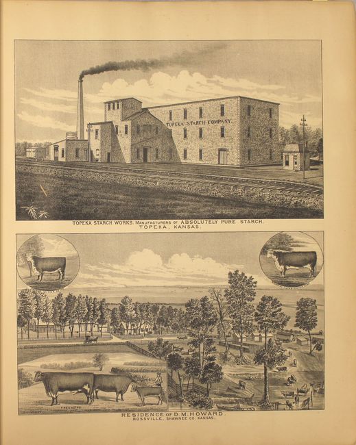
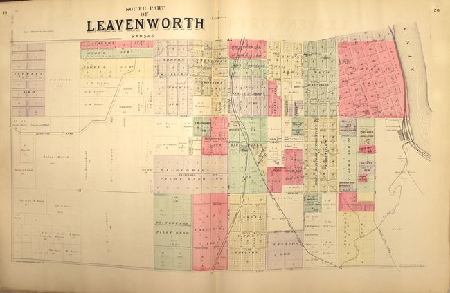
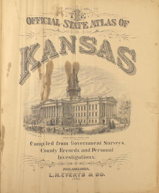
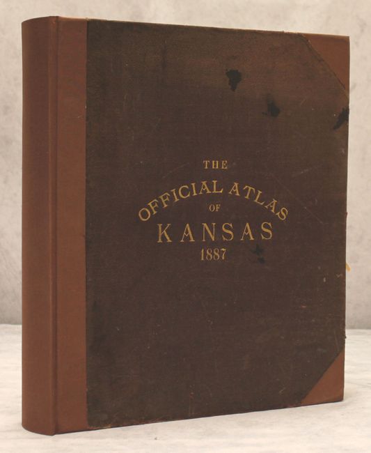
This is the scarce, first official state atlas of Kansas which is absolutely filled with information. It contains 217 single-page, 36 double-page, and 25 folding maps printed on thin banknote-style paper. The maps depict counties and townships in very fine detail. In addition to the maps, there are numerous views and illustrations depicting public buildings, parks, hotels, farms, and financial institutions demonstrating the explosive growth the state was experincing during the decade. The associated text features the "Names of Leading Citizens who have Aided in the Publication of the Official State Atlas of Kansas" showing their property and the livestock they raised, serving as a testament to the success these individuals experienced and the implied marketing behind it to future settlers. 339 pp. Elephant folio, professionally rebound in brown cloth and tips over original brown leather boards with gilt title on front cover.
References: Phillips (Atlases) #1710.
Condition: B+
The maps are very good to near fine. The text is generally very good with some minor loss along the bottom edge of the sheets at the front and back, several cello tape repairs (not to the maps), and the first few pages are creased. Rebound with a few surface abrasions to the covers.