Subject: Atlases
Period: 1821 (published)
Publication:
Color: Hand Color
Size:
12.4 x 17.9 inches
31.5 x 45.5 cm
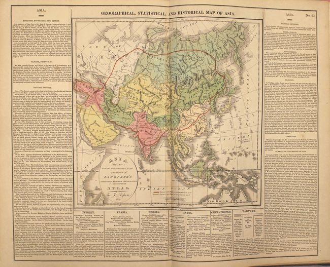
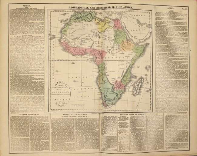
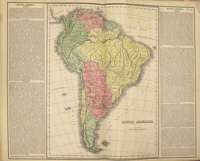
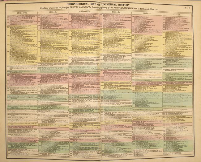
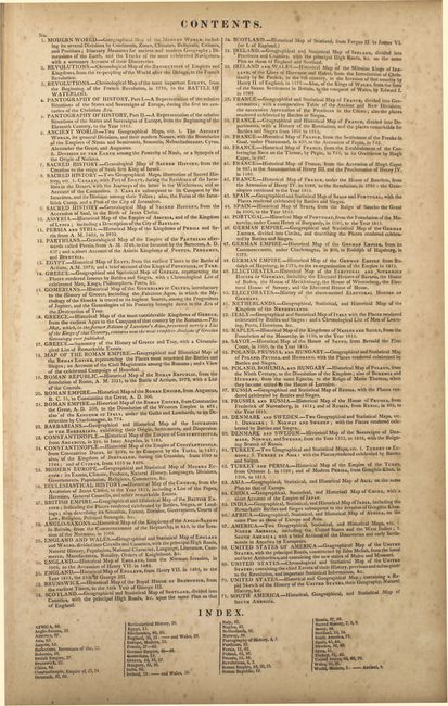
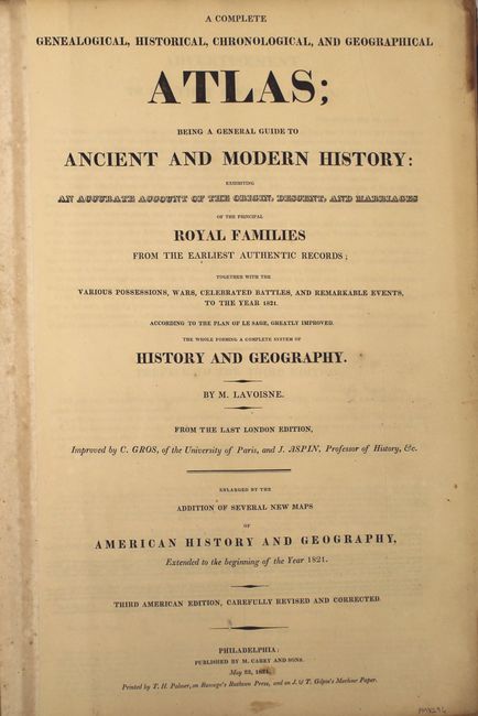
This is Lavoisne's third American edition folio atlas "carefully revised and corrected" by C. Gros and J. Aspin. Published by M. Carey and Sons, and printed by T.H. Palmer "on Ramage's Ruthven Press, and on J. & T. Gilpin's Machine Paper." The atlas is complete and contains 23 double-page and 10 single-page maps, plus scores of detailed and colorful tables, chronological and historical. The maps are listed below.
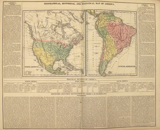
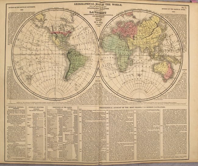
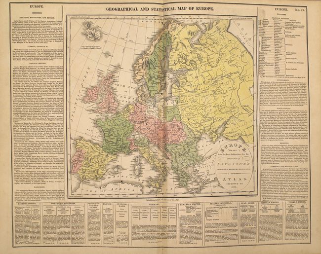
World in hemispheres; Ancient World of Noah (two single-page maps); Canaan & Egypt (two single-page maps); Ancient Greece; Roman Empire; Incursion of the Barbarians; Europe 1821; England, Scotland & Ireland; England & Wales; Scotland; Ireland; France (statistical); France (historical); Spain & Portugal; Germany; Kingdom of Netherlands; Italy; Poland & Hungary; Russia; Denmark & Scandinavia (two single-page maps); Turkey & Greece (two single-page maps); Asia; China; India; Africa; North America & South America (two single-page maps); United States; and South America.
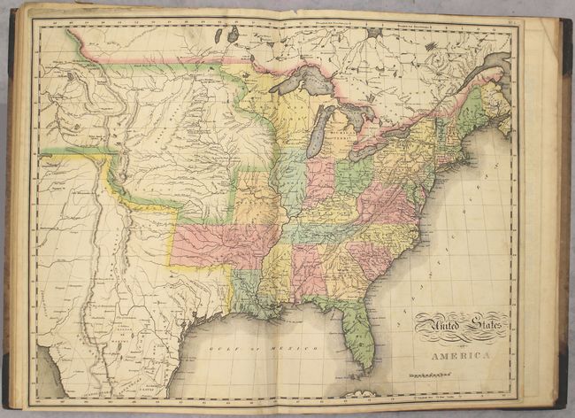
The United States map, by John Melish, provides a detailed view of the Missouri River and the headwaters of the Columbia River based on information from Lewis and Clark's expedition. The new state of Missouri is shown with a straight western border. Michigan Territory includes the eastern part of present-day Wisconsin, which is still a part of the North West Territory. The large Arkansas Territory takes in most of present-day Oklahoma. Texas is a part of Mexico. One of the most interesting features of the map is the river system in the West, near Long's Peak, where the headwaters of several major rivers all originate within a few miles of one another - Colorado, Columbia, Rio del Norte (Rio Grande), Arkansa (Arkansas), and the Platte.
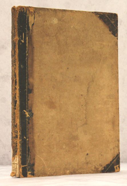
Hardbound in quarter calf and tips with gilt decorations and title on spine. Title page, introduction, contents, maps and tables.
References:
Condition: B+
The maps and tables all have full original color and excellent impressions. Most plates have light toning along the centerfold, and there is occasional scattered foxing and minor soiling. The map of the US has light offsetting and a faint damp stain at bottom right. Several tables have short tears at bottom and a few pages are dog-eared. The endpapers are in poor condition. The hinges are starting, the covers are soiled and worn, and a portion of the backstrip is missing at bottom.