Subject: Pacific Ocean
Period: 1877 (dated)
Publication: Petermann's Geographische Mitteilungen
Color: Printed Color
Size:
20.9 x 17.2 inches
53.1 x 43.7 cm
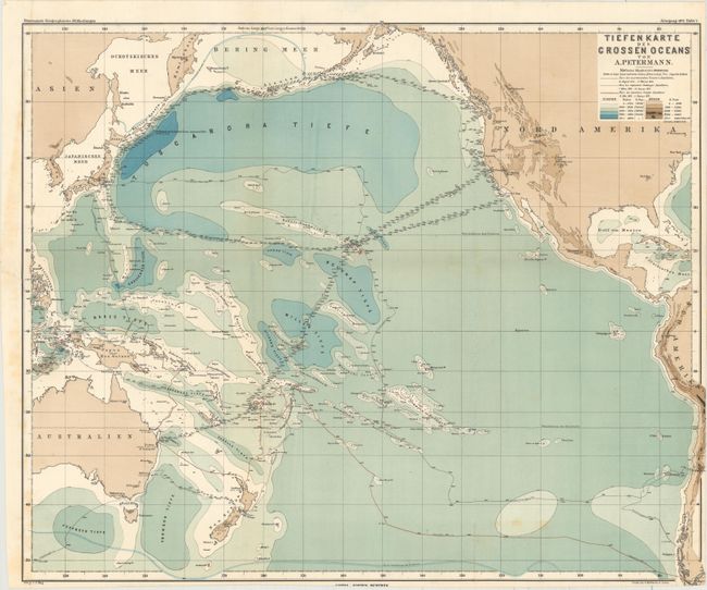
This is the first bathymetric chart of the Pacific Ocean, and the first to show the recently discovered Mariana Trench, here referred to as Challenger Tiefe after the ship that took the staggering reading of 4475 fathoms in 1875. The routes of numerous survey vessels are traced through the ocean with their corresponding soundings. The Pacific is color-coded by depth of seafloor, while the land shown is color-coded by elevation. Published by Justus Perthes.
References:
Condition: B+
Issued folding with a few spots of foxing, faint offsetting, and a binding tear that enters about 0.5" into image at left that has been closed on verso with archival tape. The sheet has been trimmed slightly at bottom and at right, as issued, so that a tiny amount of the image is missing.