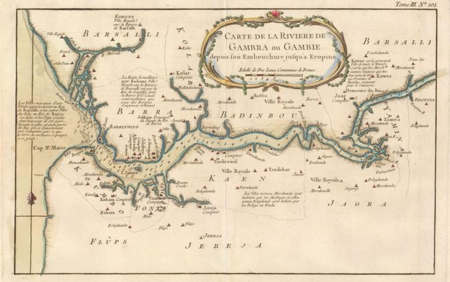
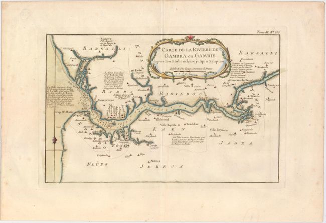
Subject: Gambia
Period: 1764 (circa)
Publication: Le Petit Atlas Maritime
Color: Hand Color
Size:
12.8 x 8.1 inches
32.5 x 20.6 cm
This copper-engraved map focuses on the Gambia River from its mouth to Eropina, based on the explorations of John Leach on behalf of the Royal Company of Africa. The map features many place names, settlements and villages. Notes on the region are included, such as navigational notes, descriptions of the local people, and the locations where salt and rice are produced. The Royal Company of Africa had established English settlements along this river, which accounts for the amount of detail provided. Trading rights to the region were purchased by England from Portugal in 1588. The independent republic of Gambia was formed in 1965. Adorned with a decorative rococo-style title cartouche, scale of miles and simple compass rose.
References:
Condition: A
A nice impression on watermarked paper with wide margins and minor offsetting.