Catalog Archive
Auction 152, Lot 692

"Carte de la Guinee Contenant les Isles du Cap Verd, le Senegal, la Cote de Guinee Proprement Dite, les Royaumes de Loango...", Santini/Remondini

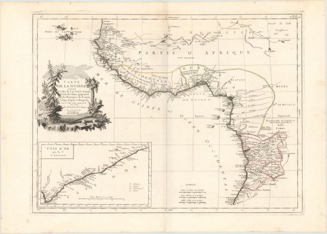
Subject: Western Africa

Period: 1779 (dated)

Publication: Atlas Universel...

Color: Hand Color

Size:
24.1 x 17.7 inches
61.2 x 45 cm
Download High Resolution Image
(or just click on image to launch the Zoom viewer)

This elegant map of western Africa is based on a map by Bonne. It provides a detailed view of the coastal regions from Cote d'Ivoire to Angola. Political divisions, towns and cities, rivers, mountains, deserts, and more are identified. The interior of the continent is still largely unexplored. Cape Verde appears off the coast. An inset at bottom left focuses on the Gold Coast, with a key to identify the region's colonizers. The decorative title cartouche features a predatory cat and a crocodile.

References:

Condition: A

A fine impression and original outline color on a sturdy watermarked sheet with a faint damp stain around the centerfold at top, marginal soiling, and a short tear at top left, away from image.

Estimate: $200 - $240

Sold for: $75

Closed on 2/18/2015

Archived