Subject: Africa
Period: 1631 (circa)
Publication:
Color: Hand Color
Size:
21.9 x 16.3 inches
55.6 x 41.4 cm
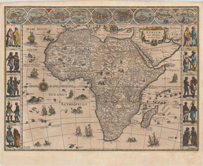
This is one of the most decorative seventeenth century maps of the African continent and a superb example of the Dutch carte-a-figures style. The map is surrounded on three sides with vignettes of native peoples and nine principal cities. The Nile is shown according to Ptolemy with its sources arising in the lakes Zaire and Zaflan, the fictitious Lake Sachaf of Laurent Fries appears, as well as the R. de Spirito Santo. The map is further embellished with numerous ships, sea monsters (including a great seahorse), a compass rose and exotic animals wandering all over the continent. This is the second state of the map. Latin text on verso, published between 1631-35.
References: Betz #57.2; Norwich #32; Van der Krogt (Vol. II) #8600:2.
Condition: B+
Lightly toned with slightly faded original color and a couple of small spots. There is a professionally repaired tear in the bottom blank margin, as well as several tiny tears in the blank margins that have been archivally repaired. Trimmed to neatline at top and professionally remargined.