Subject: Africa
Period: 1550 (published)
Publication: Cosmographia
Color: Black & White
Size:
13.4 x 10 inches
34 x 25.4 cm
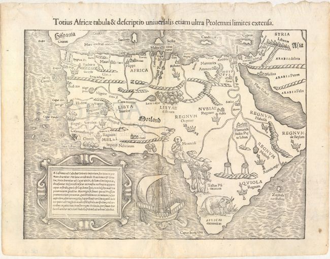
This is one of the first modern maps of the whole continent. The Ptolemaic geography, with large rivers and convoluted mountains, is augmented from Portuguese and Arabic sources. From the Portuguese comes Caput Bonespei (Cape of Good Hope) and a small group of islands off the eastern coast named Zaphala Aurifodina that were supposedly the region from which King Solomon imported gold and silver. The Arab kingdoms of Quiola and Melinde appear in eastern Africa and Hamarich, the capital of the mythical Christian king Prester John, is shown at the confluence of the twin sources of the Nile. The island of Madagascar is strangely absent, even though its presence was known from the time of Marco Polo. The map is illustrated with crowns and scepters indicating kingdoms, forests, parrots, an elephant, a Cyclops (Monoculi) and a large galleon under full sail. The strapwork cartouche contains a text description of the continent. The Latin title is above the map.
References: Betz #3, variant 7; Norwich #2; Tooley (MCC-29) #10.
Condition: B+
There is minor toning along the centerfold, faint show-through of text on verso, and professional repairs to a few short separations along the centerfold at top and bottom.