Subject: Pakistan, Afghanistan & Northern India
Period: 1640 (circa)
Publication: Theatrum Orbis Terrarum
Color: Hand Color
Size:
20.5 x 16.4 inches
52.1 x 41.7 cm
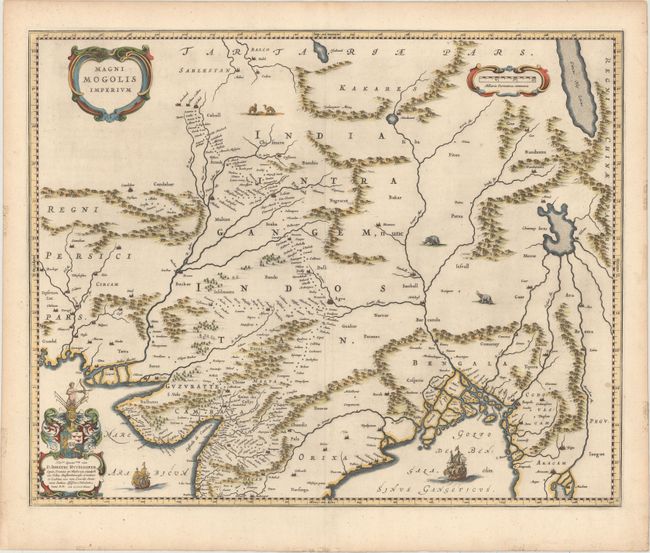
This map depicts the Empire of the Great Moghul in northern India, including the region from Iran to Burma (Myanmar). The important travel route from Kabul to Surat is the most prominent feature of the map. This was the route traveled by the embassy of the Englishman Sir Thomas Roe to the Moghul emperor Jahangir in 1615, as derived from a map published by William Baffin in London in 1618. This Dutch version of Baffin's map remained the standard Dutch view of the region throughout the seventeenth century. Finely decorated with strapwork title and scale of miles cartouches, a dedication with coat of arms, sailing ships, elephants and camels. Latin text on verso, published between 1640-55.
References: Van der Krogt (Vol. II) #8330:2.
Condition: A
Excellent impression and color on watermarked paper with a light crease adjacent to centerfold and one small, unobtrusive spot.