Subject: Sumatra
Period: 1775 (circa)
Publication: Le Neptune Oriental
Color: Black & White
Size:
19.1 x 26.4 inches
48.5 x 67.1 cm
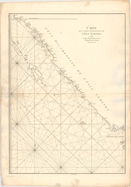
This sea chart depicts the southern portion of the western coastline of Sumatra, from just north of the equator to Lampung Bay and the Sunda Strait. The islands of Enggano (Isla Trompeuse) and Krakatoa (I. Du Prince), as well as the western tip of Java are noted. Numerous soundings, rocks, and shoals are shown. Engraved by Guillaume Nicolas Delahaye.
A French sailor and hydrographer, D' Après de Mannevillette (1707-1780) used new instruments to correct the latitudes measured by previous explorers. His atlas Le Neptune Oriental, first published in 1745, was considered a major achievement and an indispensable resource for navigators.
References: Shirley (BL Atlases) M.APR-1c.
Condition: B
A sharp impression on a sturdy, watermarked sheet with a damp stain along the centerfold at left, two pairs of small worm holes along the centerfold, light soiling, and faint offsetting.