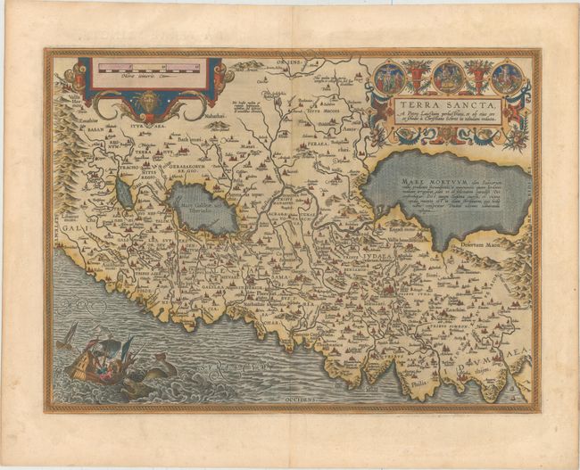
Subject: Holy Land
Period: 1598 (published)
Publication: Theatrum Orbis Terrarum
Color: Hand Color
Size:
19.8 x 14.5 inches
50.3 x 36.8 cm
This striking map is considered the most 'modern' of Ortelius' maps of the Holy Land. It is a very detailed map, centered on Samaria, with north oriented to the left. The map was drawn by Christian Schrot with cartography based on Peter Laicksteen's wall map describing his 1566 visit to the Holy Land. The elaborate title cartouche incorporates vignettes of the birth, crucifixion and resurrection of Jesus. The map is further adorned with a bold distance scale featuring the head of Medusa and a dramatic scene depicting Jonah falling from a ship into the waiting jaws of the whale. French text on verso.
References: Laor #543; Nebenzahl (HL) plt. 31; Van den Broecke #173.
Condition: A
Excellent impression and color with wide margins and one tiny hole in an unengraved area near top center that has been professionally repaired.