Catalog Archive
Auction 152, Lot 565

"Theatrum Historicum ad Annum Christi Quadringentesimu in quo tu Imperii Romani tu Barbarorum...", Delisle, Guillaume

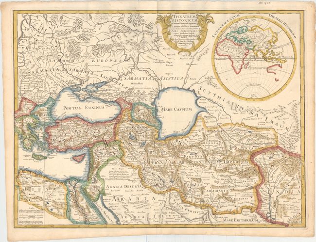
Subject: Eastern Mediterranean & Middle East

Period: 1705 (dated)

Publication:

Color: Hand Color

Size:
25.5 x 19.1 inches
64.8 x 48.5 cm
Download High Resolution Image
(or just click on image to launch the Zoom viewer)

Decorative copperplate map of the Middle East extends east to include the Caspian and part of India, illustrating the eastern extent of the Roman Empire. The Caspian Sea is depicted in a round shape. A large inset at upper right is the Eastern Hemisphere which partially delineates Australia and suggests it and Papua New Guinea are connected. Decorative title cartouche. The Delisle address at Quai de l'Horloge indicates the map was actually published 1708-1726. Engraved by des Rosiers.

References:

Condition: A

A bright, clean example on watermarked paper with a couple of insignificant spots and minor toning along edges of sheet.

Estimate: $220 - $250

Sold for: $150

Closed on 2/18/2015

Archived