Subject: Southern Greece
Period: 1623 (published)
Publication: Gerardi Mercatoris Atlas sive Cosmographicae…
Color: Hand Color
Size:
16.5 x 13.4 inches
41.9 x 34 cm
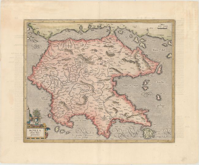
A beautiful and decorative map of the Peloponnesos peninsula in southern Greece. This region was called Morea well into the 19th century. The narrow isthmus that separates the mainland from the peninsula on this map is now bisected by the Corinth Canal, built in 1893, effectively turning the Peloponnesos peninsula into an island. The map is adorned with a decorative strapwork and floral cartouche. Latin text on verso.
References: Van der Krogt (Vol. I) #7820:1A.1; Zacharakis #1449.
Condition: B+
Attractive color with professional repairs along the centerfold and three faint lines in manuscript ink along the centerfold at bottom.