Subject: Russia, Baltic States
Period: 1782 (dated)
Publication: Atlas Universel...
Color: Hand Color
Size:
19.2 x 24.9 inches
48.8 x 63.2 cm
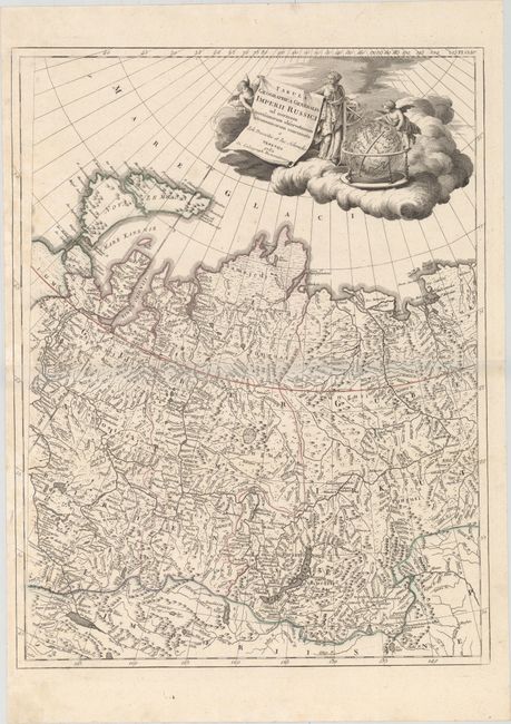
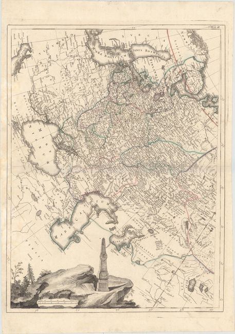
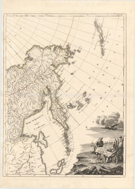
This handsome map details the vast expanse of Russia over three sheets. Spanning from the Baltic Sea to Kamchatka, it is filled with political divisions, town and city names, rivers, lakes, and topographical detail. In the North Pacific, the Aleutian Islands are visible. The map was based on the comprehensive surveying work of Jacob Schmidt and Johann Treskot, done for Peter the Great. The western sheet includes a vignette at bottom left that depicts a monument to Catherine the Great on a cliffside. At the top of the central sheet is a decorative title cartouche featuring allegorical figures and cartographic tools. The eastern sheet shows Catherine the Great surrounded by symbols of military might as she examines a map illustrating the extension of the Russian Empire after the Russo-Turkish War of 1768-74. After this war, southern Ukraine, Crimea, and part of North Caucasus fell under Russian control. Each sheet stands on its own with full borders.
References:
Condition: B+
Sharp impressions and original outline color on sturdy watermarked paper with light damp stains confined to the left of the sheets and minor soiling that is mostly confined to the blank margins. The central sheet also has a printer's crease at left center.