Subject: Central Europe
Period: 1711 (circa)
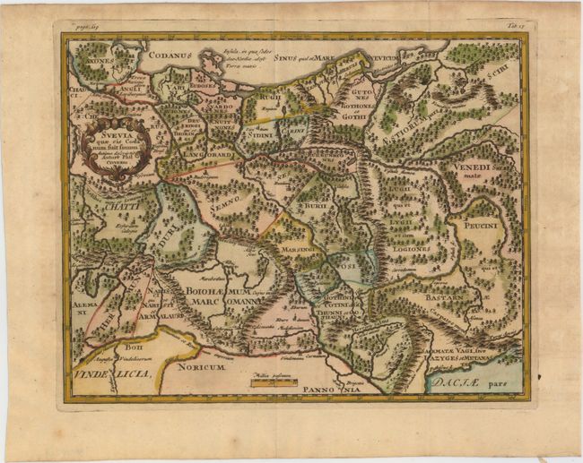
Publication: Introductio in Universam Geographicam
Color: Hand Color
Size:
9.6 x 7.6 inches
24.4 x 19.3 cm
Densely engraved small map showing the ancient Germanic tribes, covering the region of present-day Germany, Poland, Czech Republic, and Slovak Republic, extending south to the Danube River. It is adorned with a wreath-style title cartouche.
Cluver's Introductio in Universam Geographicam was a popular atlas, appearing in over 45 editions during a 100-year period. The first edition was published without maps in the 1620s, and the first edition to include maps was published circa 1641. The various editions were published in different cities throughout Europe, including Amsterdam, Nuremberg, and London. This map is from a London edition, with the majority of the maps re-engraved by John Senex.
References: Shirley (BL Atlases) T.CLUV-9a #13.
Condition: B+
A nice impression with attractive color and light toning. Issued folding with minor offsetting in right blank margin.