Subject: Central Europe, Germany
Period: 1650 (circa)
Publication:
Color: Hand Color
Size:
14.3 x 12.1 inches
36.3 x 30.7 cm
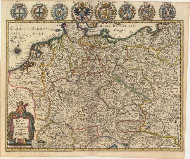
This map of the German Empire covers present-day Germany, Poland, Netherlands, Belgium, Switzerland, Austria, Czech Republic and parts of Poland and Hungary. The map is densely engraved with information on political boundaries, towns, rivers, and topography. The decorative cartouche features a cherub, grapes, and other fruits. This is an uncommon edition with eight superb coats of arms added above the map, including the imperial double-headed eagle of the German Empire and the coats of arms of Trier, Cologne, Mainz, the Kingdom of Bohemia, Rhineland-Palatinate (Pfaltz), Saxony, and Brandenburg.
References:
Condition: B+
A fine impression with attractive color on watermarked paper. There are minor archival repairs along the centerfold and some extraneous creasing at top and in bottom corners.