Catalog Archive
Auction 152, Lot 454

"Britannia & Normandia cum Confinib Regionibus", Mercator/Hondius

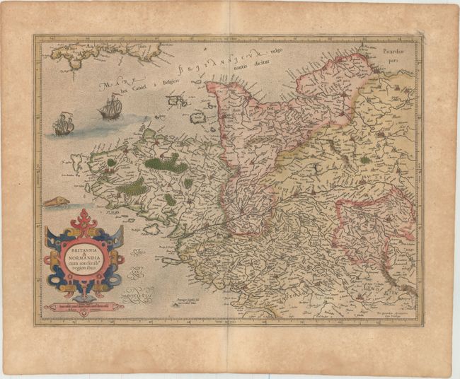
Subject: Northwestern France

Period: 1623 (published)

Publication: Gerardi Mercatoris Atlas sive Cosmographicae…

Color: Hand Color

Size:
18.7 x 13.9 inches
47.5 x 35.3 cm
Download High Resolution Image
(or just click on image to launch the Zoom viewer)

This is a fine early map of Brittany and Normandy decorated with a bold strapwork cartouche, sailing ships and a sea monster. The map provides an excellent view of the cities, villages, rivers, mountains and forests. This map first appeared in 1585 and was then published in Mercator's Atlas Sive Cosmographicae... in 1595. In 1604, the copperplates for the atlas were sold to Jodocus Hondius, who reissued the Atlas beginning in 1606. Latin text on verso.

References: Van der Krogt (Vol. I) #4001:1.

Condition: B+

Attractive color with light toning and foxing primarily confined to the blank margins. There are damp stains confined to the bottom blank margin.

Estimate: $160 - $190

Sold for: $120

Closed on 2/18/2015

Archived