Subject: Southern Belgium
Period: 1579 (dated)
Publication: Theatrum Orbis Terrarum
Color: Hand Color
Size:
20.1 x 15.1 inches
51.1 x 38.4 cm
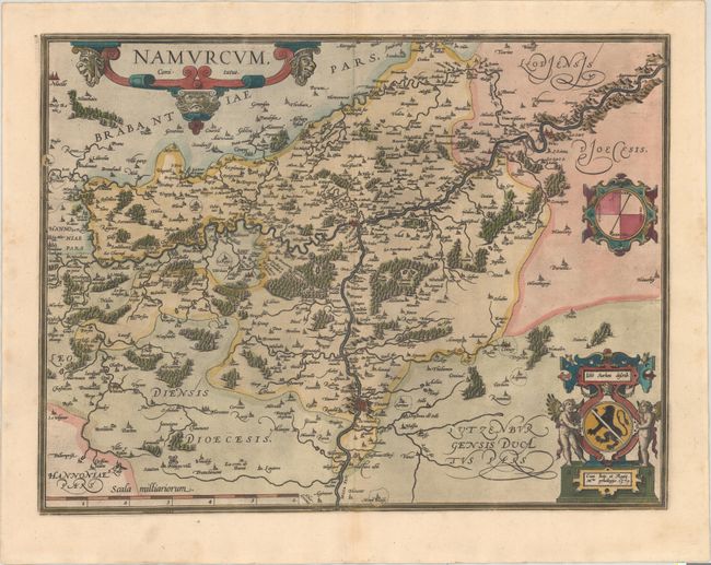
This fine map centered on Namur is richly embellished with forests, cities, mountains. This map is based on a manuscript map drawn by Jacques Surhon in 1555, which was suppressed for security reasons. In 1579, when Antwerp became independent for a brief period of time, Ortelius was able to use the manuscript map to create this copper plate. The map is adorned with an elaborate strapwork title cartouche, a compass rose, and a secondary cartouche containing the coat of arms of the region and the privilege imprint. This is the first state. Latin text on verso, published in 1595.
References: Van den Broecke #68.
Condition: A
Fine impression and color on watermarked paper with a printer's crease adjacent to centerfold.