Subject: Denmark
Period: 1711 (circa)
Publication: Introductio in Universam Geographicam
Color: Hand Color
Size:
9.7 x 7.9 inches
24.6 x 20.1 cm
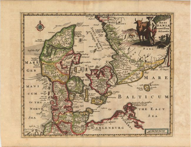
This charming small map shows the historical regions in Denmark and the tip of Sweden. The map is fully engraved with rivers, forests and ancient cities and is embellished with a compass rose and a decorative title cartouche featuring Mercury and several bulls in a pasture.
Cluver's Introductio in Universam Geographicam was a popular atlas, appearing in over 45 editions during a 100-year period. The first edition was published without maps in the 1620s, and the first edition to include maps was published circa 1641. The various editions were published in different cities throughout Europe, including Amsterdam, Nuremberg, and London. This map is from a London edition, with the majority of the maps re-engraved by John Senex.
References: Shirley (BL Atlases) T.CLUV-9a.
Condition: A
A nice impression with attractive color on watermarked paper and a hint of offsetting. Issued folding. There are faint damp stains in top blank margin, far from image.