Subject: England & Wales
Period: 1748 (circa)
Publication: Geographia Magni Britannii
Color: Hand Color
Size:
6.8 x 5.7 inches
17.3 x 14.5 cm
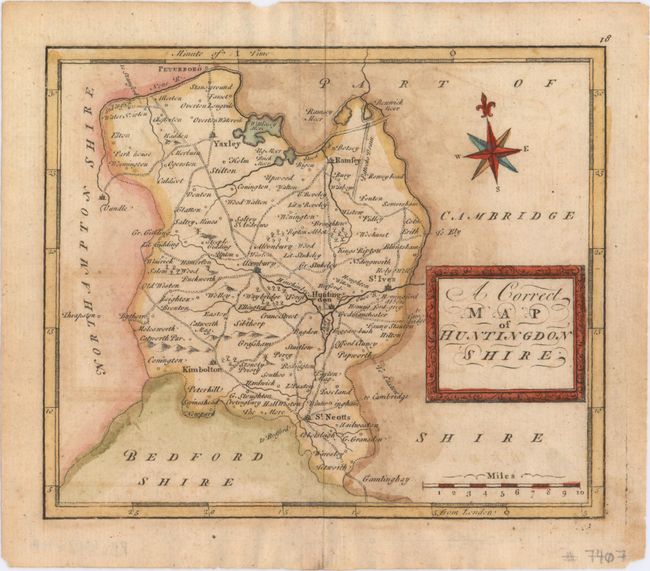
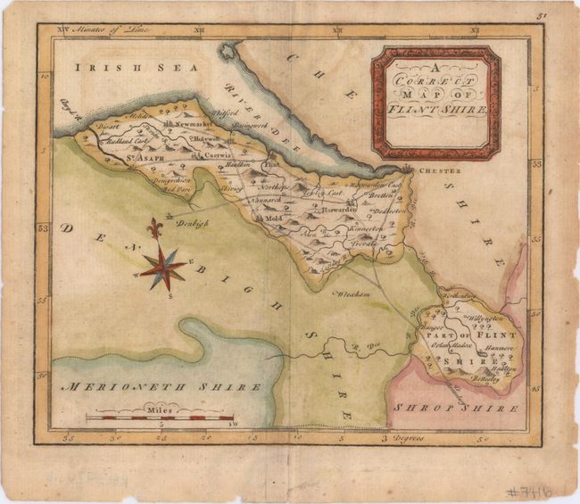
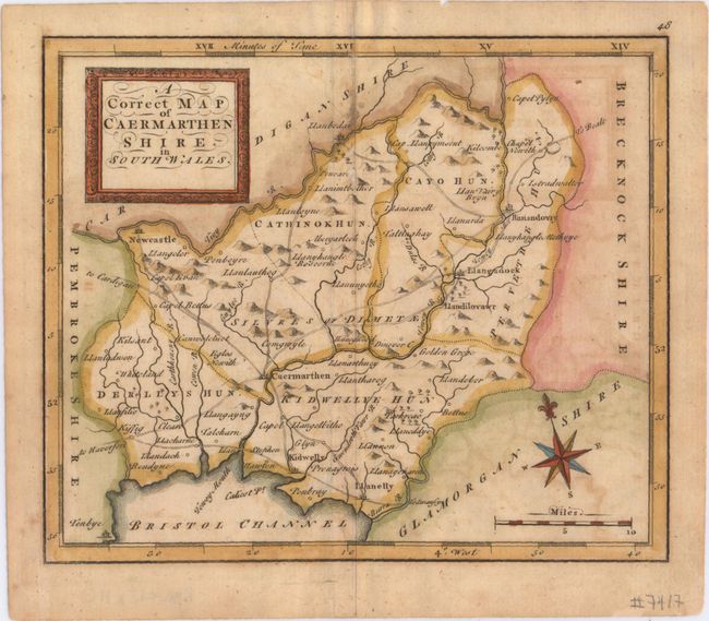
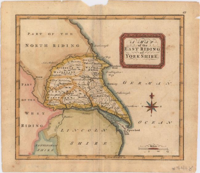
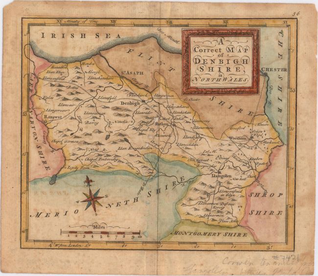
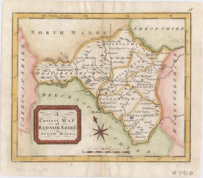
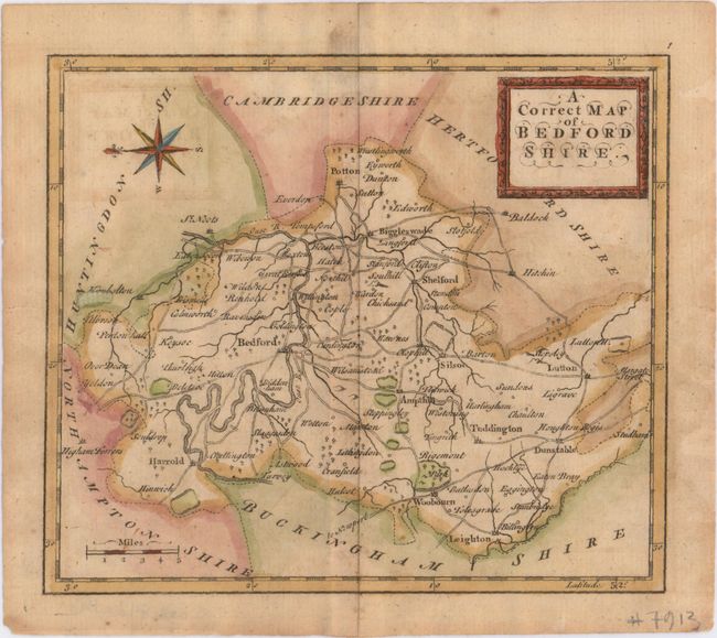
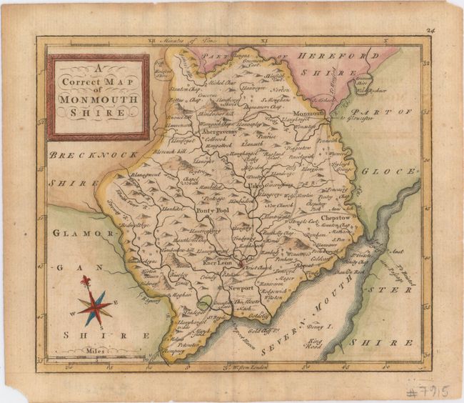
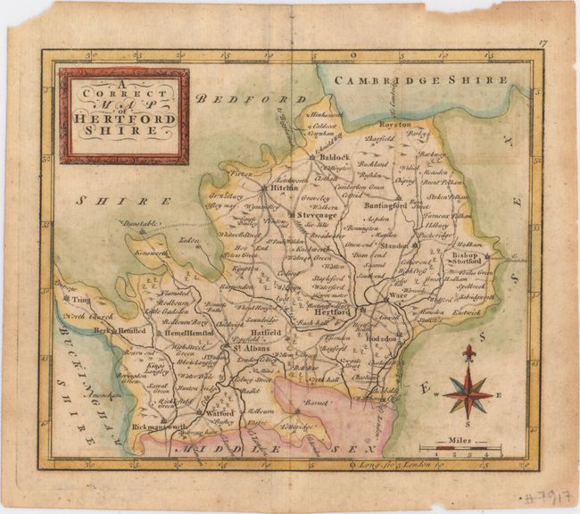
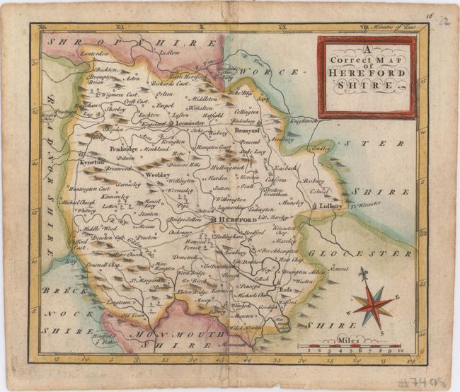
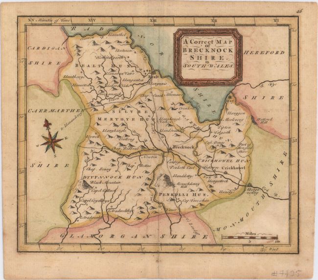
This lot of maps was published in Osborne's Geographia Magni Britannii and engraved by Thomas Hutchinson. Each of the maps depict towns and villages, roads, rivers and topography. Adorned by a decorative title cartouche, distance scale and compass rose with fleur-de-lis. Size varies slightly.
A. A Correct Map of Huntingdon Shire.
B. A Correct Map of Flint Shire.
C. A Correct Map of Caermarthen Shire in South Wales.
D. A Map of the East Riding of Yorkshire.
E. A Correct Map of Denbigh Shire in North Wales.
F. A Correct Map of Radnor Shire in South Wales.
G. A Correct Map of Bedford Shire.
H. A Correct Map of Monmouth Shire.
I. A Correct Map of Hertford Shire.
J. A Correct Map of Hereford Shire.
K. A Correct Map of Brecknock Shire in South Wales.
References:
Condition: B
The maps range in condition from good to very good with overall light to moderate toning, a few small spots, and minor offsetting.