Subject: England & Wales
Period: 1623 (published)
Publication: Gerardi Mercatoris Atlas sive Cosmographicae…
Color: Hand Color
Size:
18.6 x 13.9 inches
47.2 x 35.3 cm
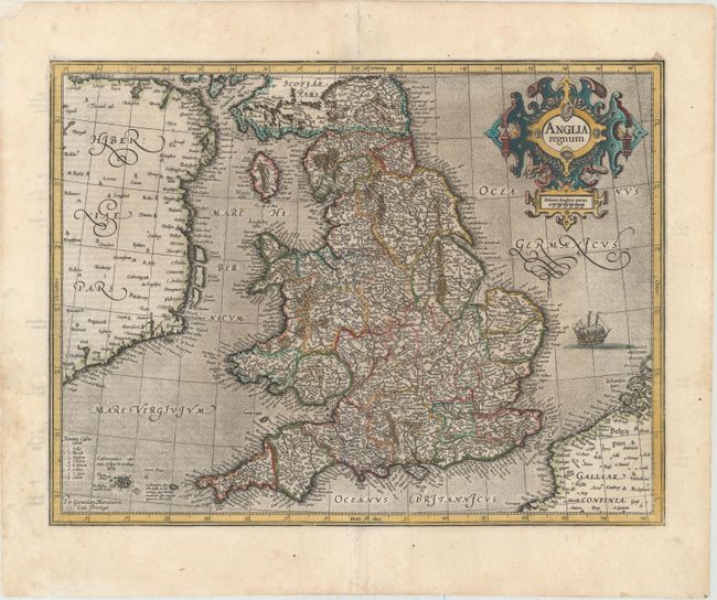
This attractive map of Elizabethan England is filled with names taken from Saxton's map of 1579. County boundaries and the Latinized names of counties are shown. The map is beautifully engraved in Mercator's characteristic style featuring a stipple engraved sea with a sailing ship, bold calligraphy and a handsome title cartouche. Latin text on verso.
References: Shirley (BI to 1650) #181; Van der Krogt (Vol. I) #5100:1A.1.
Condition: A
Excellent impression and color with professional repairs to a centerfold separation and tear in bottom blank margin and a small chip at top left. There is a faint damp stain at bottom left, causing some paper weakness and tears, which have also been professionally repaired.