Subject: Southwestern England
Period: 1693 (circa)
Publication: Great Britains Coasting Pilot…
Color: Hand Color
Size:
22.1 x 17.6 inches
56.1 x 44.7 cm
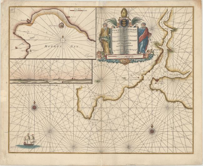
This handsome chart shows the city of Fowey at the mouth of the River Fowey in south Cornwall, with the coastline extending to Polkerris in the west. Only a few place names are identified on the chart, with the focus being on the navigational details, including soundings, rocks, shoals, and anchorages. At top left is a large inset of Mount's Bay, to the west of Fowey, with a land approach view of Fowey shown just below. The map is embellished with two compass roses, a sailing ship, and a decorative title cartouche featuring mer-folk, putti, and a large coat of arms. The chart is dedicated to Jonathan Lord Bishop of Bristol. Engraved by Ja. Clerk.
In 1681 Capt. Greenville Collins (fl.1669-1694) an officer in the Royal Navy was appointed by the Admiralty to make a complete survey of the coasts of Great Britain. Prior to this date the charts used by English mariners were copies of Dutch charts that had many inaccuracies. The task of surveying the entire coasts was formidable and took about 7 years, at the end of which only 46 surveys were finally used in an atlas titled "Great Britain's Coasting-Pilot Being a New and Exact Survey of the Sea-Coast of England," which was first published in 1693.
References: Shirley (BL Atlases) M.COLL-1a #9.
Condition: B+
A nice impression on a sturdy sheet with archival repairs to several separations along the centerfold and small chips in top corners. There are some small mildew stains at far left.