Subject: Europe
Period: 1644 (circa)
Publication: Theatrum Orbis Terrarum
Color: Hand Color
Size:
21.9 x 16.2 inches
55.6 x 41.1 cm
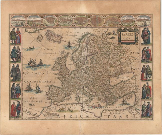
This classic map of Europe is presented in the carte-de-figures style with vignettes on three sides. The upper frieze has nine bird's-eye views of Amsterdam, Prague, Constantinople, Venice, Rome, Paris, London, Toledo and Lisbon. The side borders contain the costumes of the noblemen and women of ten European nations. The map is embellished with sailing ships, sea monsters, bears and Neptune riding a dolphin and holding his trident. A beautiful map produced at the height of the Golden Age of Dutch mapmaking; it was included in the first volume of Blaeu's magnificent atlas. Latin text on verso, published between 1644-55.
References: Goss (Blaeu) #4, p.30; Van der Krogt (Vol. II) #1000:2.
Condition: B
Wide original margins and original color. There is some uneven toning and old repairs on the centerfold margins with a minor repaired tear at bottom center that just enters the map border.