Subject: North Atlantic
Period: 1815 (circa)
Publication: Thomson's New General Atlas
Color: Hand Color
Size:
24.4 x 19.5 inches
62 x 49.5 cm
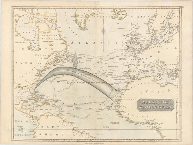
This large chart focuses on the important shipping lanes to North America and the West Indies. Of particular note are the shipping tracks of Nelson to the West Indies in pursuit of the French in 1805, the track from England to Newfoundland, and the tracks of the U.S.S. Insurgent. The Gulf Stream According to Governor Pownall is a prominent arc spanning from Florida to the northwest coast of Africa. There are numerous notations regarding navigational hazards and sightings and the coastlines are well charted. Engraved by J. Moffat.
References:
Condition: B+
On a watermarked sheet with light soiling and minor toning around the centerfold and in the blank margins.