Subject: Chile
Period: 1671 (circa)
Publication: De Nieuwe en Onbekende Weereld
Color: Hand Color
Size:
14.1 x 11.3 inches
35.8 x 28.7 cm
Montanus' work was perhaps the greatest illustrated book on the New World produced in the seventeenth century. It contained over one hundred beautifully engraved plates, views, and maps of North and South America. The plates vividly depict forts, festivals, occupations, Dutch fleets, battles, religious rites, and customs of the native inhabitants. This important work was translated into German by Olivier Dapper, and into English by John Ogilby. Several of the plates were later acquired by Pierre Vander Aa.
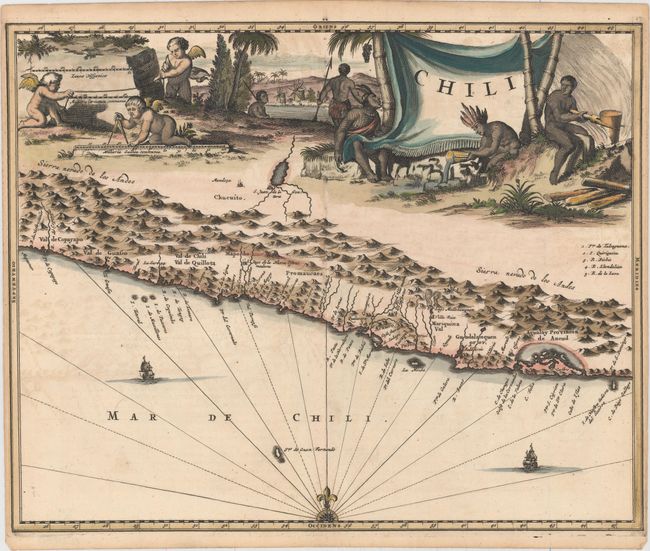
A very attractive map covering the known coastal region of Chile. The map is based on the cartography of Hessel Gerritsz with north oriented to the left although the compass rose incorrectly depicts north at top. The Andes are shown prominently, with two live volcanoes in the vicinity of Villarrica. San Juan is shown on a large spurious lake east of the Andes and incorrectly located south of Mendoza. The map is very decorative with a large scene of industrious natives and cherubs filling the entire top of the map. The ocean is embellished with two galleons and a compass rose.
References:
Condition: A
Attractive color with a horse watermark. A dark impression with very light offsetting and narrow side margins, as issued.