Subject: Dominica
Period: 1780 (circa)
Publication: Pilote Americain 2.e Partie
Color: Hand Color
Size:
18.6 x 23.8 inches
47.2 x 60.5 cm
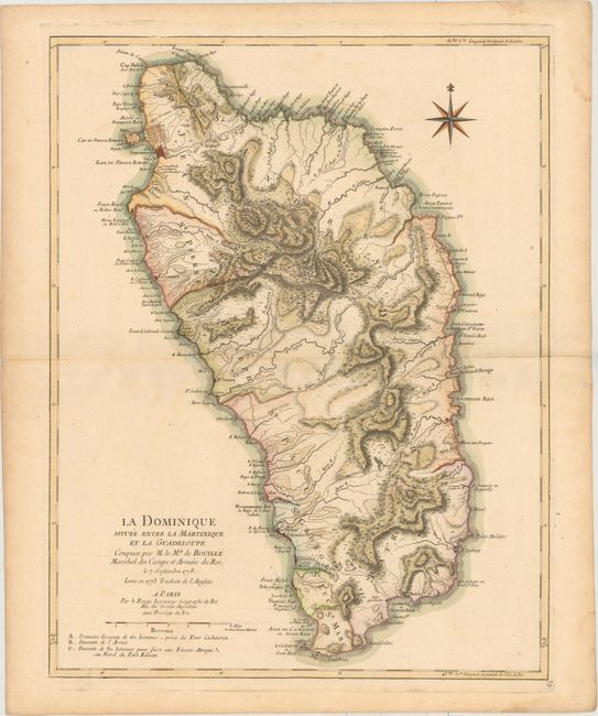
This large-scale map of the island of Dominica captures the nature of this rugged Caribbean isle in great detail. It shows the island following the French take over in 1778. During the 18th century, the English and French fought for ownership of this island, as it was strategically important to their colonial influence in the region. In 1763 Dominica was officially ceded to Britain. The French military then attacked the British fortifications in 1778, encouraged by the American War of Independence, and won. This map is very similar to Phillipe Buache's Carte de la Dominique Prise par les François le Septembre 1778 except it is lacking the insets showing the French military plans. The map shows the island divided into ten parishes with topography and good coastal detail. The towns of Roseau and Portsmouth are shown with their fortifications. The map is decorated with a striking compass rose.
References: Shirley (BL Atlases) M.LER-2a #29.
Condition: B+
Heavy, watermarked paper with attractive color and minor soiling.